Rest of the work week: A few storms possible Wednesday, then drying out and turning a little cooler
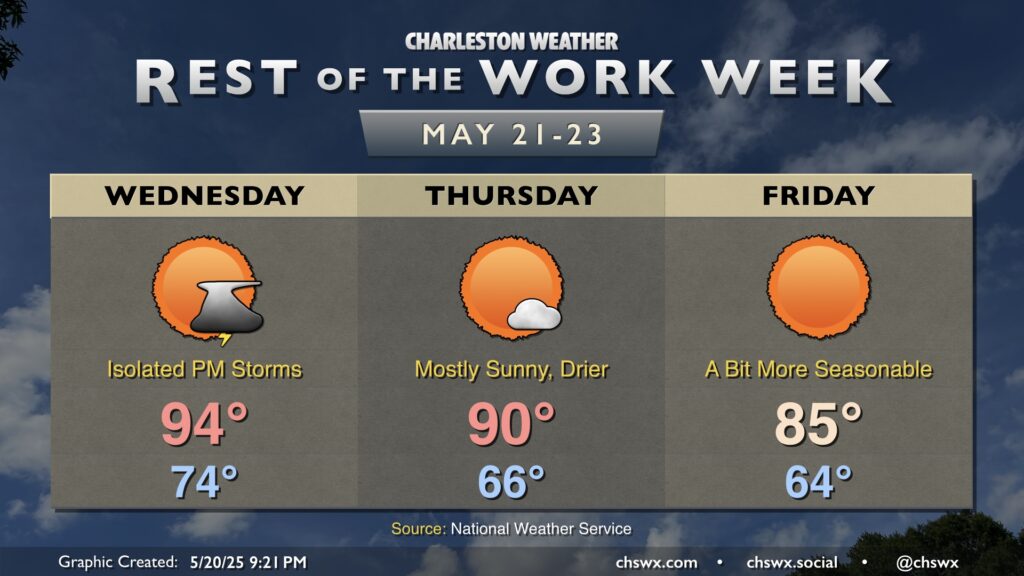
The unseasonable warmth of the past week and change will draw to a close on Wednesday as a cold front approaches the area. We’ll start Wednesday in the mid-70s, warming to the mid-90s in the afternoon. There’s a chance for a storm or two ahead of the front, but it’s conceivable that many of us may not see any rain at all with this frontal passage. If a storm or two can get going, it could turn strong to severe, but the chances are very low.
From there, drier air filters into the area, which will drop lows into the mid-60s. And while highs reach around 90° again on Thursday, dewpoints will be some 10-15° lower, making for a much more comfortable day than we’ve had the past few days. The cooler and drier airmass is reinforced for Friday, which looks to be a rather brilliant day with lows in the mid-60s, highs in the mid-80s, and unfettered sunshine.
Memorial Day weekend: Starting out on the cool side of normal, but warming back up
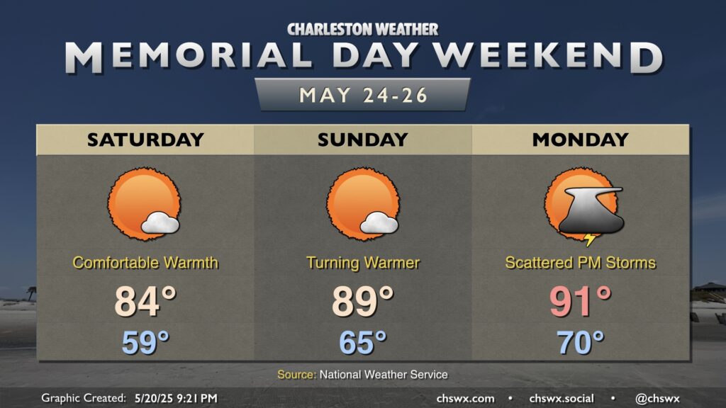
The comfortable warmth continues heading into Saturday, which may feature lows dipping into the upper 50s — an increasingly rare occurrence the deeper into the year we get — and temperatures heading to a late-spring standard mid-80s in the afternoon with just a few clouds. We’ll start to warm back up beginning Sunday, though, as highs once again flirt with 90°. By Monday, more humid air returns with lows around 70° and highs in the low 90s as a warm front lifts north across the area. A few showers and thunderstorms will be possible as well. They’re nothing plan-canceling, but you’ll want to be aware of changing conditions if you are out and about on Memorial Day.