Thursday: Afternoon storms return
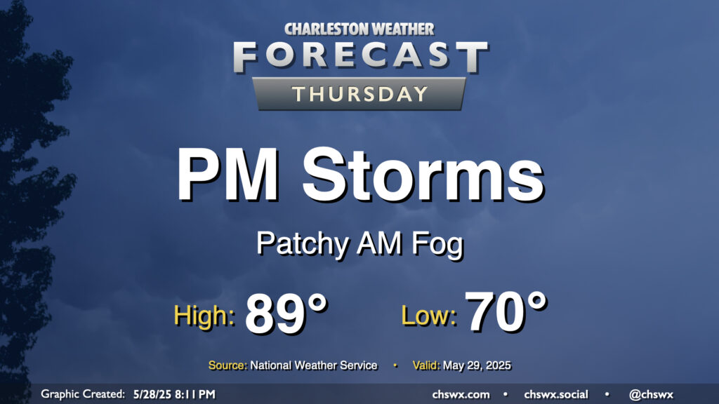
After a balmy start in the low 70s that could feature some patches of fog, temperatures will warm to near 90° in the afternoon before scattered to numerous showers and thunderstorms kick off courtesy of the seabreeze as well as some energy aloft. Heavy rain will be possible with these thunderstorms, and a few stronger storms with strong winds will be possible as well, with some of the high-res models pointing to clusters of storms developing and moving from southwest to northeast across the Lowcountry late in the day. Stay alert for rapidly changing conditions, particularly during the evening commute.
Friday & the weekend: Stormy Friday but a beautiful payoff for the weekend
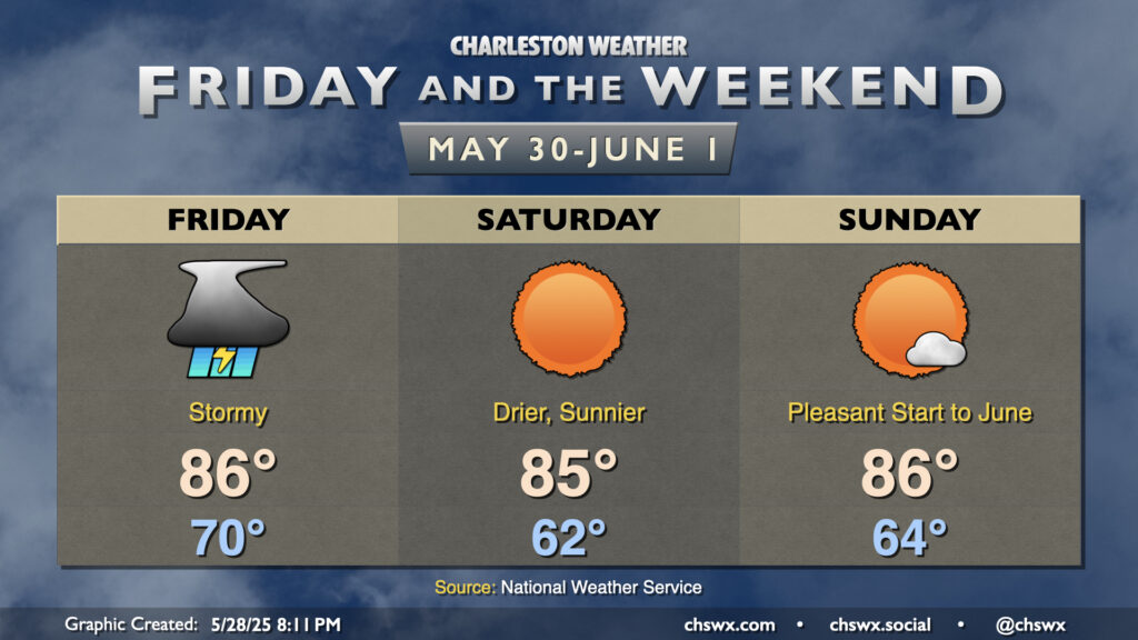
A cold front will approach the area on Friday, bringing with it the risk for strong to even a few severe thunderstorms in the afternoon and evening hours (largely dependent on if storms develop earlier in the day, which could sap some of the available instability). We’ll start the day around 70°, warming to the mid-80s in the afternoon with daytime highs governed by cloud cover and storms.
Once the front is through, cooler and drier air will move into the area, yielding a beautiful weekend across the Lowcountry to close out May and welcome in June (and climatological summer). Temperatures on Saturday start noticeably cooler, with lows bottoming out in the low 60s (and maybe even some upper 50s in more inland and rural areas). We’ll warm to the mid-80s in the afternoon with maybe a cloud or two in the sky at most. Sunday looks similar, if not a touch warmer, as high pressure continues to build into the area. Expect just a few clouds and another comfortably and seasonably warm day to start June — certainly a nice respite from the recent deluge.
Follow my Charleston Weather updates on Mastodon, Bluesky, Instagram, Facebook, or directly in a feed reader. Do you like what you see here? Please consider supporting my independent, hype-averse weather journalism and become a supporter on Patreon for a broader look at all things #chswx!