Tuesday: One more quiet day, then the rain begins again
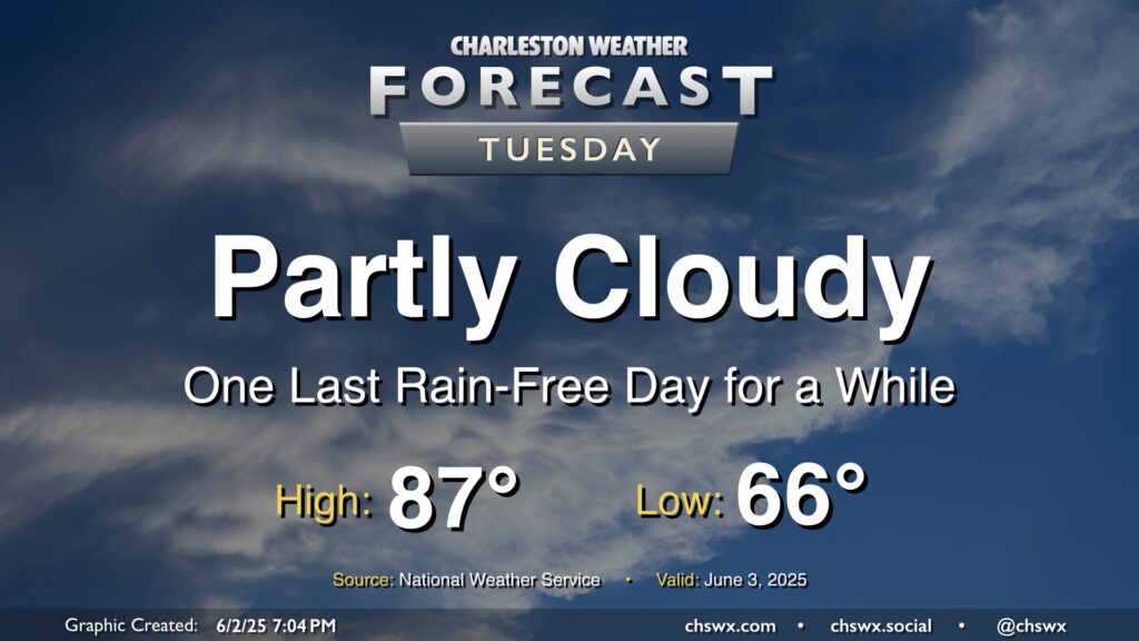
We’ve got one more day of quiet weather in store for Tuesday before low pressure offshore begins to send moisture back our direction starting Wednesday. Temperatures Tuesday start in the mid-60s, and we’ll warm to the mid-to-upper 80s under generally partly cloudy skies as high pressure builds in briefly from the north.
Rest of the work week: Low pressure organizes offshore, enhancing rainfall
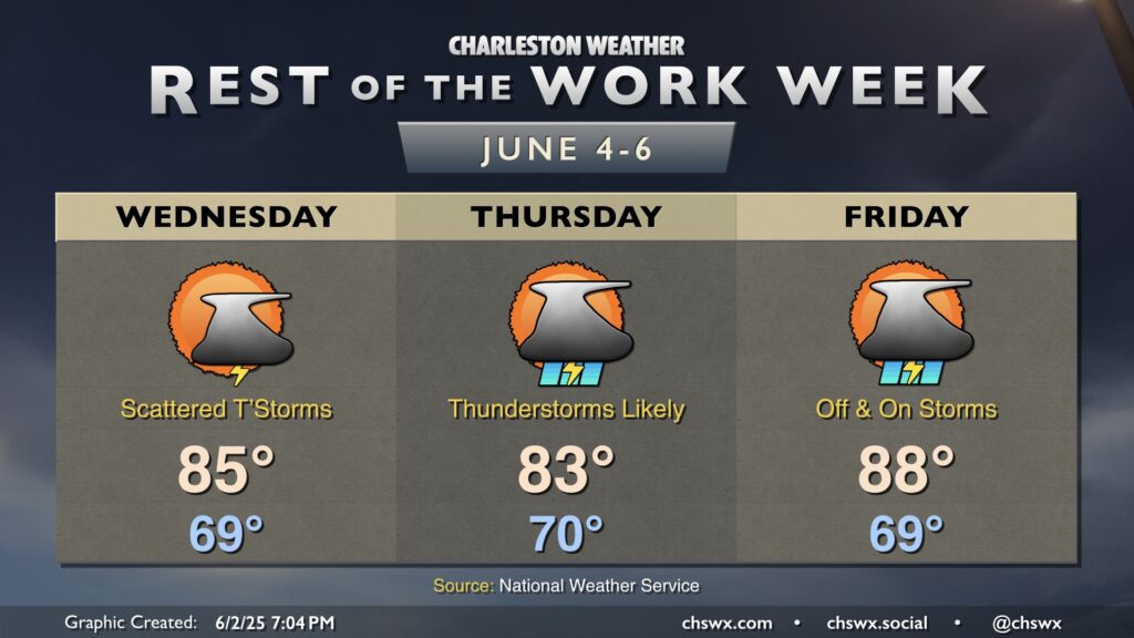
The rest of the work week will turn increasingly unsettled, peaking Wednesday night into Thursday as low pressure offshore makes its closest approach to the area.
Wednesday will feature generally a scattering of thunderstorms — no washout expected in any one location — with high temperatures running a little below normal for this point in the year. However, as the low organizes, we’ll start to see an uptick in coverage from south to north. Expect numerous showers and thunderstorms on Thursday, with muggy lows around 70° and rain-cooled highs in the low 80s. Excessive rainfall is a concern, and we’ll need to monitor for the risk for flooding in some spots as a result.
It’s worth noting that there is a non-zero chance that the low pressure system could acquire some tropical characteristics, and NHC gives it a 10% chance for it to do so. However, regardless of tropical characteristics, rainfall impacts generally look to remain the same, so don’t get too concerned if it does end up getting classified as something tropical.
Coverage decreases a bit Friday as the low lifts away from the area, but scattered to numerous showers and thunderstorms remain possible especially in the afternoon and evening hours. Highs will jump back into the upper 80s, with temperatures perhaps reaching 90° over the weekend ahead of a cold front which will help keep things unsettled.