Friday & the weekend: Turning hotter, severe risk increases
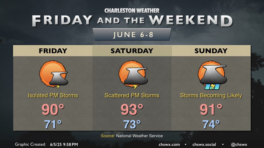
The good news for Friday is that storm chances trend downward, with just some isolated storms on the seabreeze expected in the afternoon. We could stand to dry out a bit, especially after the deluge in Summerville on Thursday, and Friday gives some of us an opportunity to do exactly that. It’ll be very summerlike, though, with highs around 90° after a low 70s start, and low-70s dewpoints will make it feel more like the mid-to-upper 90s.
Saturday will turn even warmer, with air temperatures in the low-to-mid-90s combining with low-70s dewpoints for heat indices peaking around 100° in the afternoon. Showers and thunderstorms will develop along and ahead of the seabreeze, and we’ll also need to keep an eye to our west for the potential for a thunderstorm complex to move in, bringing with it an increased risk for damaging wind gusts. This will need to be watched as we head into the weekend.
Strong to severe thunderstorms remain possible on Sunday afternoon, with a bit more coverage expected as well as some energy moves in aloft. Temperatures on Sunday remain balmy, with lows in the mid-70s warming to the low 90s in the afternoon. Heat indices should once again climb into the upper 90s before showers and thunderstorms re-enter the picture. Storms become likely across the area later in the afternoon into the evening as the seabreeze interacts with the energy aloft. Don’t cancel any plans, but be ready to move outdoor activities inside at a moment’s notice.