Weekend forecast: Warm and occasionally stormy
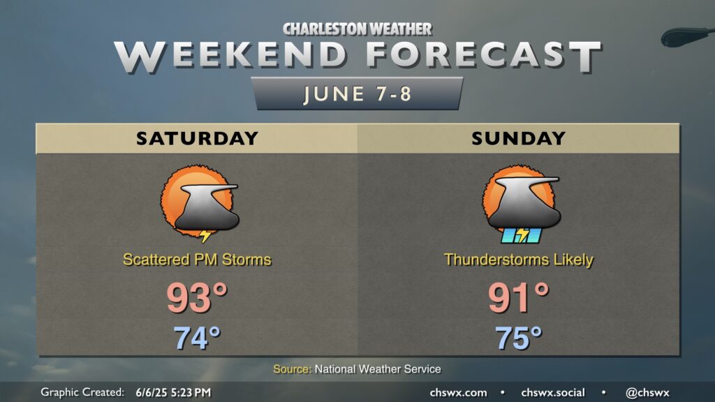
Heat and humidity will continue to feature prominently in the weekend’s weather as we watch disturbances to our west potentially introduce a risk for strong to severe thunderstorms at times. If you have outdoor activities planned this weekend, keep a close eye on the weather.
Friday night into Saturday morning will be quite warm by early June standards, with lows potentially not dropping below 80° at the beaches. This kicks the experimental Heat Risk into the Major category for the Charleston metro area, so be sure to check on those who may not have adequate air conditioning or hydration.
From there, temperatures will warm to the low-to-mid-90s in the afternoon as the start of the day should be rain-free. We’ll be monitoring a thunderstorm complex to the west to see if it can move into the area Saturday afternoon and evening. If this can take place, the atmosphere will be ripe for the potential for damaging wind gusts and hail with scattered thunderstorms, especially with any seabreeze interactions.
We’ll then need to keep an eye out for perhaps another thunderstorm complex on Sunday bringing a potential for damaging winds, though it’ll depend on how much the atmosphere gets worked over on Saturday (if at all). We will have another very balmy morning, with low temperatures ranging from the mid-70s inland to around 80° near the coast. Highs reach the low 90s before storms presumably either kick off with the seabreeze or reach the area from the west.
Stay tuned to forecast updates, especially if you have outdoor plans.