Tuesday: Storm chances return; a couple could be strong
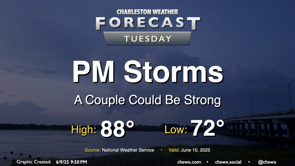
Showers and storms, a few of which could be on the strong side, will be possible again on Tuesday, particularly in the afternoon, as low pressure aloft remains in place and the heating of the day kicks in. The warm and muggy airmass stays in place, with lows in the low 70s warming to the upper 80s in the afternoon before storms develop. Guidance suggests showers and storms develop in the 2-3 PM timeframe, and there will be the risk for a storm or two to become severe once again with damaging winds the main threat. The risk for severe weather is a little lower Tuesday, but will still need to be monitored especially after a rough day for Summerville.
Rest of the work week: Staying unsettled
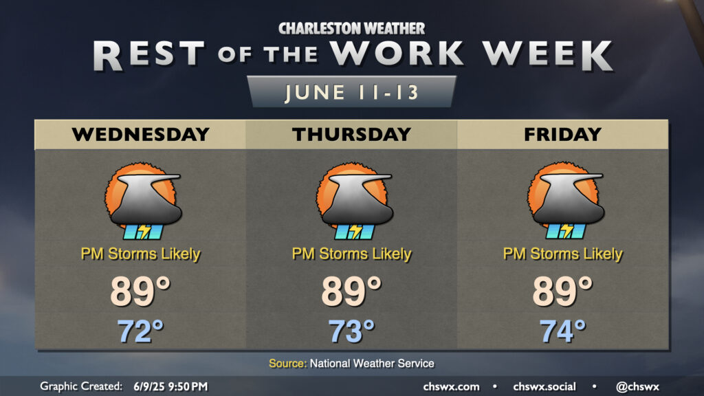
Unsettled weather continues for the rest of the work week as a front approaches and stalls out nearby on Wednesday. We’ll generally see showers and thunderstorms develop in the afternoon along and ahead of the seabreeze, moving inland through the evening. An isolated strong storm can’t be ruled out, particularly with seabreeze and outflow interactions. Temperatures will be steady-state, with low-to-mid-70s each morning yielding to highs in the upper 80s to around 90° each afternoon.
Follow my Charleston Weather updates on Mastodon, Bluesky, Instagram, Facebook, or directly in a feed reader. Do you like what you see here? Please consider supporting my independent, hype-averse weather journalism and become a supporter on Patreon for a broader look at all things #chswx!