Thursday: More afternoon storms expected
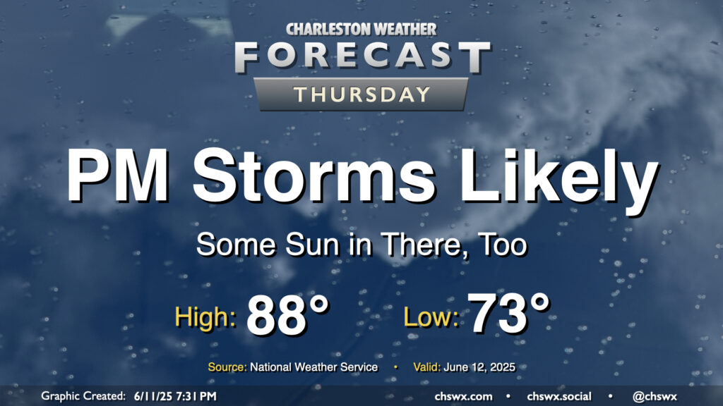
After a quiet start to the day, another round of afternoon showers and thunderstorms are expected to develop and move across parts of the Tri-County on Thursday as we remain in an unsettled pattern. Alas, we will keep this going into the weekend, too.
Temperatures on Thursday remain muggy, with lows in the low-to-mid-70s warming to the upper 80s to low 90s in the afternoon before storms get going. Heat indices will peak in the upper 90s as well, so if you’re outdoors, be sure you’re getting enough water. Scattered to numerous thunderstorms should develop along the seabreeze by mid-afternoon, translating inland with time as the seabreeze pushes in and outflow boundaries from collapsing storms act as triggers for new ones. A stray strong to severe thunderstorm can never be ruled out in this kind of setup, but the risk for widespread severe weather is low.
Friday & the weekend: More of the same
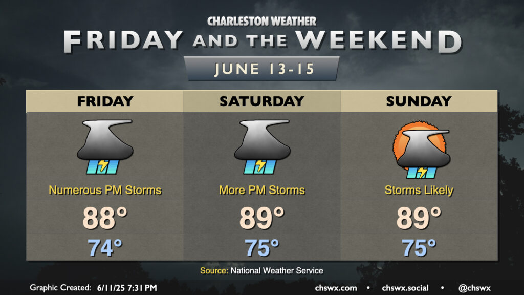
The stormy streak continues heading into Friday and the weekend as upper-air disturbances ripple through, aiding in the development of numerous showers and thunderstorms in the afternoons and evenings. It won’t rain all the time at any one location, though, so don’t expect a total washout. Temperatures remain generally steady-state, with highs in the upper 80s to around 90° expected — right in line with, if not a touch above, what’s expected at this point in June. Storms will generally remain pulse-like and disorganized, though storms can turn strong to severe where outflow boundaries collide and enhance updraft speeds. The moral here is to remember that if you are outdoors and can see lightning or hear thunder, you’re close enough to be struck — head indoors and away from windows until the storm passes.
Follow my Charleston Weather updates on Mastodon, Bluesky, Instagram, Facebook, or directly in a feed reader. Do you like what you see here? Please consider supporting my independent, hype-averse weather journalism and become a supporter on Patreon for a broader look at all things #chswx!