Tuesday: Turning warmer, a stray storm possible
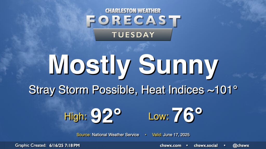
High pressure will continue to build in aloft, sending temperatures upward and storm chances downward. Tuesday will be another rather warm day, with lows in the mid-70s to start the day warming to the low 90s in the afternoon. Mix in dewpoints running in the low 70s, and that’ll yield heat indices right around the 100-101° mark during the height of the afternoon. Heat indices could even briefly spike in the immediate wake of the seabreeze as dewpoints surge before temperatures start to fall.
A storm or two will be possible along and ahead of the seabreeze, but with the capped atmosphere, it’s going to be tough to get much, if anything, to break through, much less sustain itself. Still, though, you can never completely rule it out this time of year.
Rest of the work week: Still hot, storms return late week
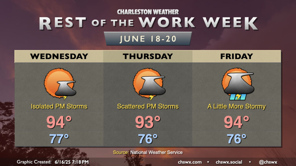
Hot weather continues as we head into the rest of the work week. Temperatures will generally run in the low-to-mid-90s each afternoon, and dewpoints in the 70s will send heat indices above 100° at peak heating. Wednesday is the most likely day for rain-free weather for many of us, while storm chances tick up a touch on Thursday evening. More scattered to numerous storms will be possible Friday as a front gets close to the area. As is typical in summertime setups, widespread severe weather is highly unlikely, but a pulse severe storm can’t be ruled out, especially as we get toward Friday.
Follow my Charleston Weather updates on Mastodon, Bluesky, Instagram, Facebook, or directly in a feed reader. Do you like what you see here? Please consider supporting my independent, hype-averse weather journalism and become a supporter on Patreon for a broader look at all things #chswx!