Thursday: Another hot day with storms possible
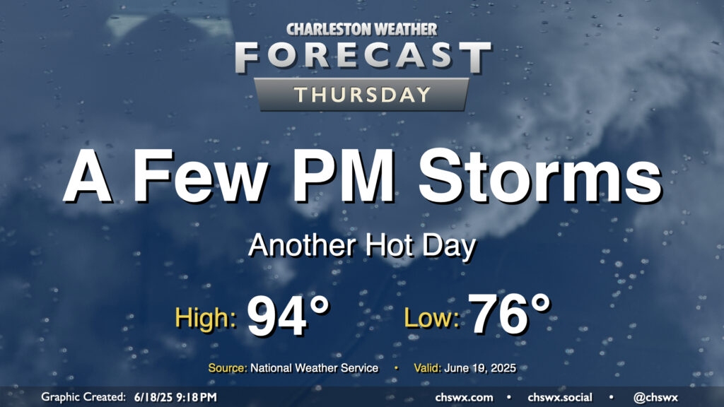
More heat and humidity are on tap for Thursday, but with a slightly better chance of storms in the afternoon especially as a front gets closer to the area. We’ll start the day in the mid-70s once again, warming back to the mid-90s in the afternoon. We’ll be keeping an eye on a line of thunderstorms to our northwest, which could help induce some stronger storms in the metro later in the afternoon through the evening hours. Damaging wind gusts would be the primary concern in the strongest storms, though the risk for severe weather is generally low (but not zero) across the area.
Friday & the weekend: Still warm and muggy; turning less stormy
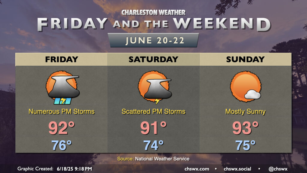
Expect showers and thunderstorms to be more numerous Friday afternoon and evening as a trough moves by, stirring up the warm and humid airmass in the process. Temperatures once again start in the mid-70s, and we’ll warm to the low 90s again in the afternoon with heat indices in the low 100s before storms get going. A damaging wind gust or two can’t be ruled out once again Friday, but locally heavy rain and cloud-to-ground lightning will be the main concerns.
Storm coverage starts to decrease as we head into the weekend with high pressure rebuilding aloft and att the surface. Isolated to scattered storms are expected Saturday afternoon, while Sunday should be largely rain-free for most of us, with more low to mid-90s heat in store.
Follow my Charleston Weather updates on Mastodon, Bluesky, Instagram, Facebook, or directly in a feed reader. Do you like what you see here? Please consider supporting my independent, hype-averse weather journalism and become a supporter on Patreon for a broader look at all things #chswx!