The week ahead: 90°+ streak continues with a couple stormy days mixed in
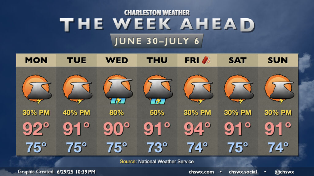
Warm, humid, and occasionally stormy days lie ahead to close out June and bring in July. (Side note: It’s insane that we’re entering the second half of 2025!) Temperatures look to remain in the 90s each afternoon, and if the forecast works out, the current 16-day streak of 90°+ high temperatures should continue through a third and into a fourth week (23 days, to be exact).
A cold front will approach the area on Wednesday into Thursday, stalling out before it reaches us (of course). This will increase the risk for showers and thunderstorms for those two days in particular, and if there’s a period that could impact that 90° streak, this is it. Regardless, it’ll still be steamy and stormy.
Decaying front may spur tropical development this weekend
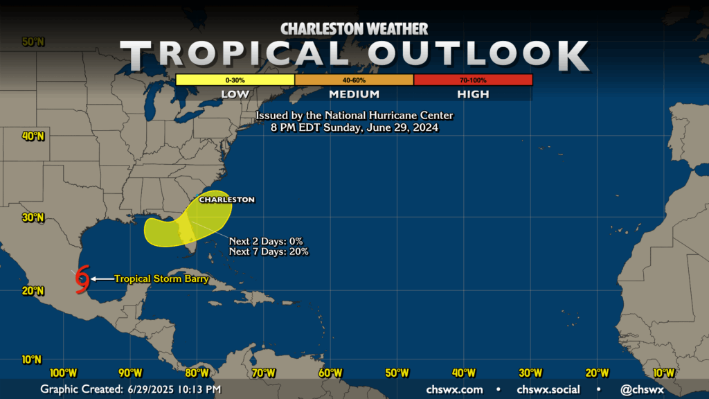
As we head into the July 4th weekend, we’ll be keeping an eye on the remnants of the front that gets close, but not quite close enough, for the potential for low pressure to spin up somewhere from the Gulf to off the Southeast coast. Often times, storms that develop during this early point in hurricane season originate from stalling and dying fronts, and there’s a small chance that this could occur over the weekend. Right now, I see nothing to disrupt your July 4th plans, with ensemble guidance currently painting the rainfall bullseye over the Gulf Coast of Florida. We’ll keep an eye on this for any changes, of course, but right now standard summertime fare with afternoon popup storms is expected for your Fourth and beyond.
Follow my Charleston Weather updates on Mastodon, Bluesky, Instagram, Facebook, or directly in a feed reader. Do you like what you see here? Please consider supporting my independent, hype-averse weather journalism and become a supporter on Patreon for a broader look at all things #chswx!