Tuesday: Another hot one with afternoon thunderstorms
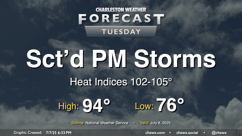
It’ll be another hot and humid July day across the Lowcountry on Tuesday as high pressure at the surface and aloft remain the predominant weather features, at least for one more day. The morning starts in the mid-70s inland to near 80° at the coast and downtown, warming to the mid-90s once again in the afternoon. Heat indices should rise in the 102-105° range, especially in the immediate wake of the seabreeze thanks to the dewpoint surge that typically accompanies it. We should see showers and thunderstorms fire along and ahead of the seabreeze by afternoon. Storms that fire could dump a good bit of rain in some spots in a short period of time thanks to the tropical airmass left behind by Chantal, so we will need to monitor for the potential for minor flooding in poor drainage areas. A stronger storm or two can never be ruled out this time of year, either, with gusty winds the main concern.
Rest of the work week: Warm and stormy
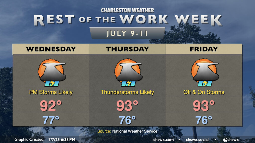
The rest of the work week will continue to feature warm temperatures and scattered to numerous afternoon and evening thunderstorms. The ridge of high pressure will weaken a little bit, increasing the coverage of storms each day while also helping to keep temperatures from soaring too far into the mid-90s. Overall, we can expect lows in the mid-to-upper 70s each morning (warmest near the coast), followed by highs peaking in the low 90s in the afternoons. Showers and thunderstorms will bring heat relief to some, but chances are good that not everyone will see a storm at the same time every day. In fact, some of you could miss out altogether. So it goes in summertime.
Follow my Charleston Weather updates on Mastodon, Bluesky, Instagram, Facebook, or directly in a feed reader. Do you like what you see here? Please consider supporting my independent, hype-averse weather journalism and become a supporter on Patreon for a broader look at all things #chswx!