The week ahead: More warmth, more afternoon storms
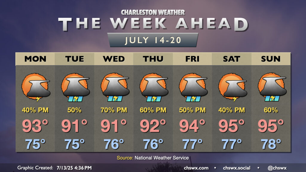
Warm temperatures and afternoon thunderstorms will continue to figure prominently in the forecast this week with high pressure rebuilding aloft.
Monday starts in the mid-70s, as will pretty much every morning this week. Temperatures will warm to the low 90s in the afternoon, with perhaps a few mid-90s a bit more inland. Showers and thunderstorms should fire up by early afternoon. Guidance generally points to a majority of the activity taking place inland of 17, and perhaps even more concentrated in the I-95 corridor. There’s some indication that a slot of drier air might slide in between low pressure offshore and high pressure to the west, which could help to suppress storm development closer to the coast, but we’ll wait and see. Keep an eye to the sky just in case, and be ready to head indoors if thunderstorms approach.
Whatever dry slot exists doesn’t last long as low pressure drifts across Florida, weakening the high pressure ridge and increasing the risk for showers and storms on Tuesday and especially Wednesday. Highs will top out in the low 90s each afternoon, with heat indices generally in the upper 90s.
The ridge builds back in across the area starting Wednesday night into Thursday, and it’s around this time when we start to see temperatures warm back toward the mid-90s each afternoon. Warming will be subtle on Thursday, though heat indices should climb back over 100°. Heading into Friday and the weekend, the ridge becomes generally more stout, and temperatures respond well, with mid-90s expected each afternoon. Heat indices will climb back into the 104-106° range — quite warm and potentially dangerous for prolonged exertion — but a little shy of the Heat Advisory criteria of 108° for two hours. Shower and thunderstorm chances will continue each afternoon, generally along and inland of the seabreeze.
Tropics: Area to watch in the Gulf, but not a concern locally
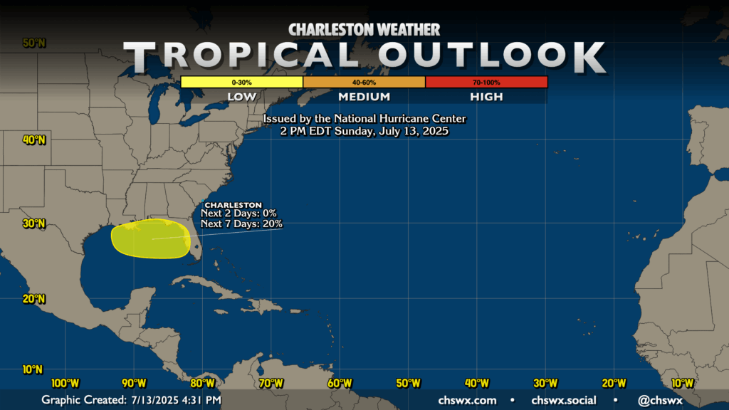
The National Hurricane Center is monitoring a spot in the Gulf for the potential for some tropical development as this week goes on. With the ridge building across the area, though, this will continue to drift westward and away from the Carolinas. We’ll keep an eye on it, of course, but right now this doesn’t look to be anything for us to be concerned about.
Follow my Charleston Weather updates on Mastodon, Bluesky, Instagram, Facebook, or directly in a feed reader. Do you like what you see here? Please consider supporting my independent, hype-averse weather journalism and become a supporter on Patreon for a broader look at all things #chswx!