Thursday: Storm chances decrease, heat starts to build
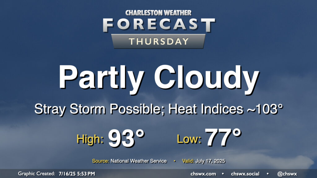
Storms will be more hit-or-miss on Thursday as high pressure aloft starts to rebuild, which will heat things up for the weekend. Temperatures will start in the mid-to-upper 70s, with lows possibly not getting below 80° at the beaches. We’ll warm to the low-to-mid-90s in the afternoon, and with limited storm coverage, heat indices should have no trouble getting into the low-to-mid-100s, especially post-seabreeze.
Friday & the weekend: Turning even hotter
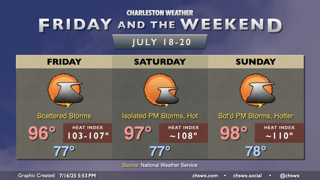
As high pressure continues to build across the area, we’ll see temperatures continue to climb with just a stray storm or two possible each afternoon. Friday will top out in the mid-90s away from the coast, and mid-70s dewpoints will yield heat indices from 103-107°. Saturday looks quite possibly like a heat advisory day with highs and dewpoints running a click warmer, potentially pushing the heat index to around 108°. Sunday may end up being the hottest of the set, as air temperatures may peak well into the upper 90s, yielding a heat index around 110°. Slightly better storm coverage is possible Sunday, so it remains to be seen how that works out. We’ll keep an eye on it, but be ready to ensure plenty of breaks in the shade and lots of fluids to stay hydrated if you’ve got outdoor plans!
Follow my Charleston Weather updates on Mastodon, Bluesky, Instagram, Facebook, or directly in a feed reader. Do you like what you see here? Please consider supporting my independent, hype-averse weather journalism and become a supporter on Patreon for a broader look at all things #chswx!