Tuesday: Still hot, but better afternoon storm chances
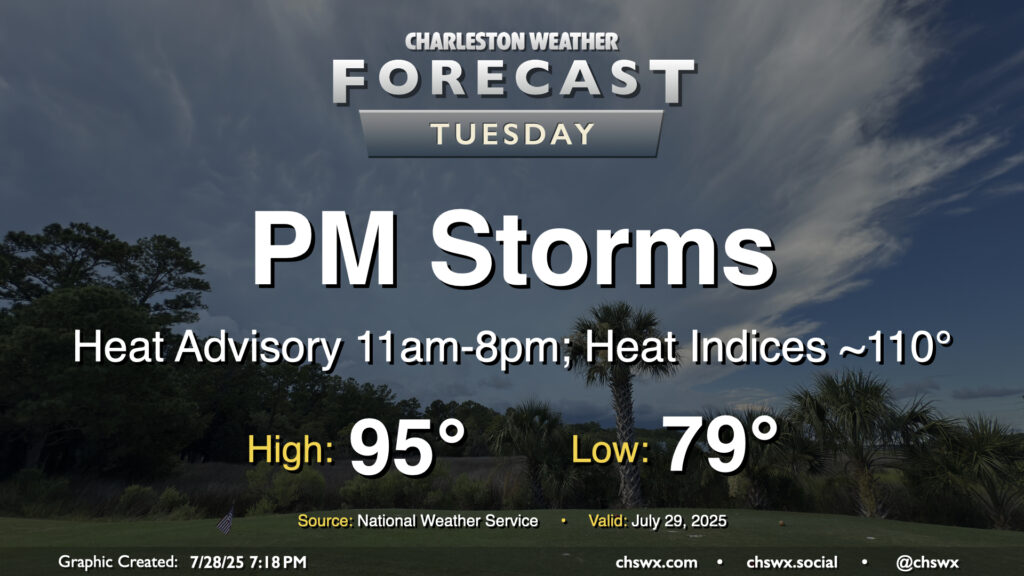
The heat wave continues on Tuesday, but we will be getting past its peak as the high pressure ridge aloft continues to migrate westward, allowing for more shower and thunderstorm activity to develop in the afternoon. We’ll still be hot enough for a Heat Advisory, with low temperatures in the upper 70s to low 80s yielding to highs in the mid-90s. Mix in mid-to-upper-70s dewpoints and you get heat indices topping out around 110° or so before showers and thunderstorms develop. Guidance generally keeps things dry through about 1-2 PM before numerous storms kick off generally away from the coast. Widespread severe weather isn’t expected, but a couple storms could produce some strong winds, and there will be a risk for flooding if storms train. Remember, every thunderstorm is dangerous because of the lightning it produces, so be sure to head indoors if a storm threatens your area.
Rest of the work week: Heat wave continues; scattered storms each afternoon
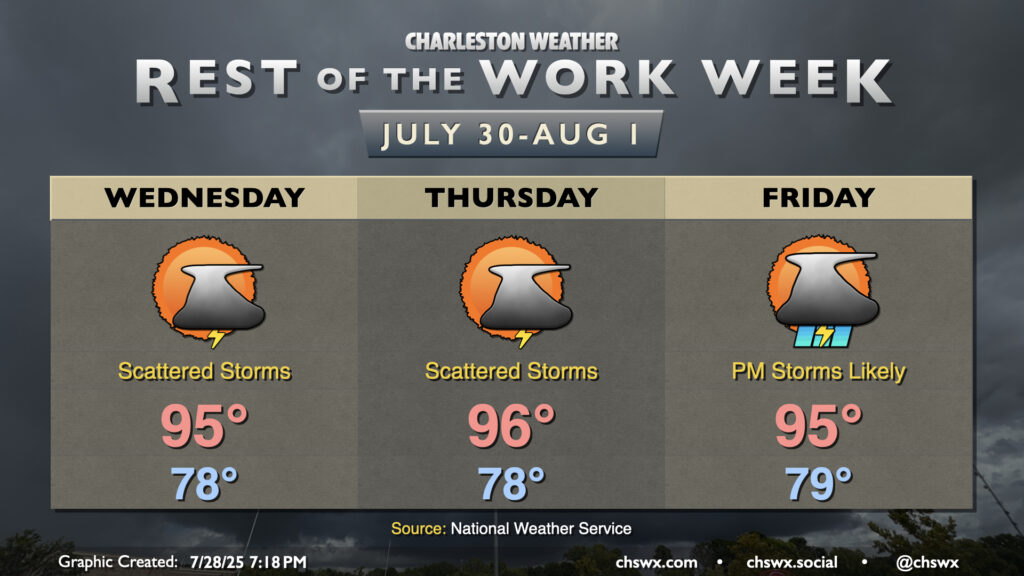
The heat wave continues for a few more days, with heat indices perhaps approaching Heat Advisory criteria each afternoon before scattered storms develop. Lows will remain quite oppressive in the upper 70s to low 80s, with air temperatures peaking in the mid-90s. Showers and thunderstorms will develop along and ahead of the seabreeze each day in a typical summertime configuration; not everyone will see a shower or storm but those who do should get some welcomed relief.
Shower and storm chances tick up a bit for Friday as a front presses southward toward the area. This front will break the heat wave over the weekend, albeit with scattered to numerous showers and thunderstorms as the front stalls out nearby, not getting quite far enough south for the driest air to filter into the area, as is standard for this time of year.
Follow my Charleston Weather updates on Mastodon, Bluesky, Instagram, Facebook, or directly in a feed reader. Do you like what you see here? Please consider supporting my independent, hype-averse weather journalism and become a supporter on Patreon for a broader look at all things #chswx!