Rest of the work week: Back to the 90s
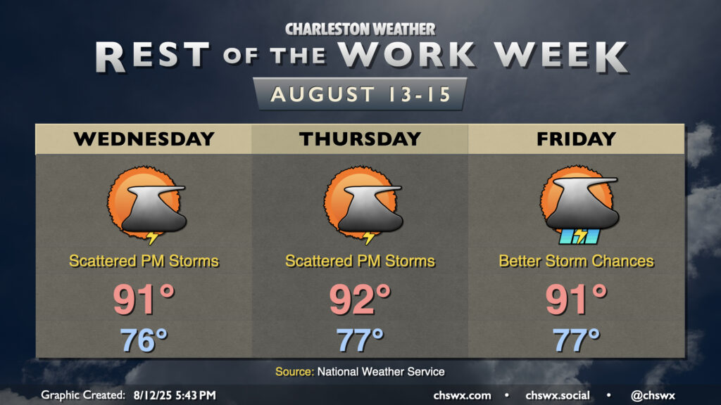
90° temperatures have been tough to come by so far this August. (Please note this is not necessarily a complaint.) Since August 1, only today (August 12) has been a 90° day. It’ll get a little easier to achieve the 90° mark going forward, though, as ridging aloft continues to build in. High pressure in the mid-levels helps temperatures heat up while keeping more widespread thunderstorm activity tamped down. We’ll have plenty of humidity in play, which will allow heat indices to head into the low 100s each afternoon — hot for sure, but not Heat Advisory hot, at least. And yes, there will be a chance for a few thunderstorms each day primarily along and ahead of the seabreeze (with perhaps better coverage on Friday). A couple storms could turn strong or even severe where outflow boundaries collide, and heavy rainfall is certainly a concern as well given deep moisture. However, once again, we’ve had much worse very recently, and shouldn’t have a replay of the past weekend for a bit. Just be ready to head indoors in case thunderstorms approach, and you’ll be fine.
Tropics: Monitoring Erin
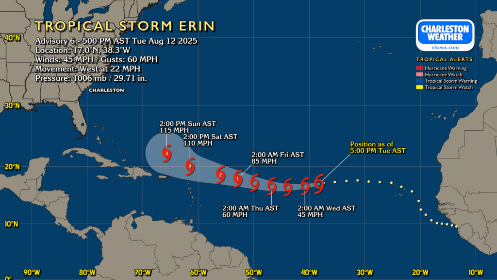
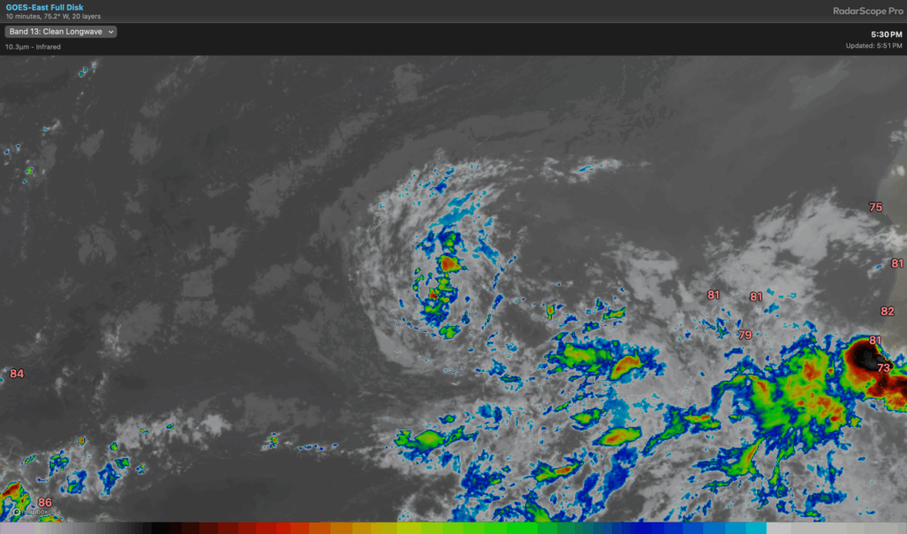
Tropical Storm Erin continues to churn well out into the Atlantic, though the conditions it’s dealing with right now aren’t terribly favorable — the water’s not quite as warm as it should be, the air around it is dry, and wind shear is acting upon it, allowing that dry air to really intrude and limit thunderstorm development. This should change as we get later into the week, though, and Erin is still expected to become a hurricane by the end of the week as it moves into a more favorable environment. It could become a major hurricane over the weekend as it moves west-northwest. Beyond Sunday, there is still uncertainty as to where Erin will end up. A weaker storm would be more south and west, potentially not getting picked up by the weakness in a high pressure ridge which is modeled in the longer range. However, the preponderance of the guidance still points to recurvature away from the East Coast for now. We’ll keep an eye on it, of course, and let you know if it becomes something to be concerned with.
Follow my Charleston Weather updates on Mastodon, Bluesky, Instagram, Facebook, or directly in a feed reader. Do you like what you see here? Please consider supporting my independent, hype-averse weather journalism and become a supporter on Patreon for a broader look at all things #chswx!