Friday & the weekend: An unsettled couple days ahead of a more traditional summertime pattern
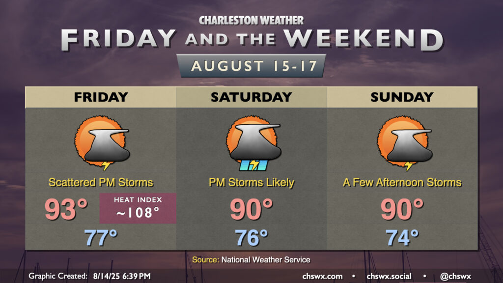
Another hot day is ahead Friday as heat indices once again climb well into the 100s under partly cloudy skies before thunderstorms develop along and ahead of the seabreeze in the afternoon. These will be generally scattered in nature — not everyone will see a storm, but those who do could get a quick round of heavy rain and gusty winds along with a good bit of lightning.
Better storm chances arrive on Saturday as a front sags south and eventually falls apart. Many of us should see a storm on Saturday, particularly in the afternoon, with plenty of triggers available for thunderstorm development. This should also help keep temperatures pinned to around 90° — still hot, but not as hot.
Lower dewpoints move in with northeast flow behind the front, giving us a little less humidity to deal with and slightly cooler temperatures as well. Ridging aloft will persist, allowing highs to get to around 90°, while a few showers and thunderstorms will be possible on the seabreeze each afternoon. We’ll keep this going into next week, too.
Tropics: Erin is strengthening
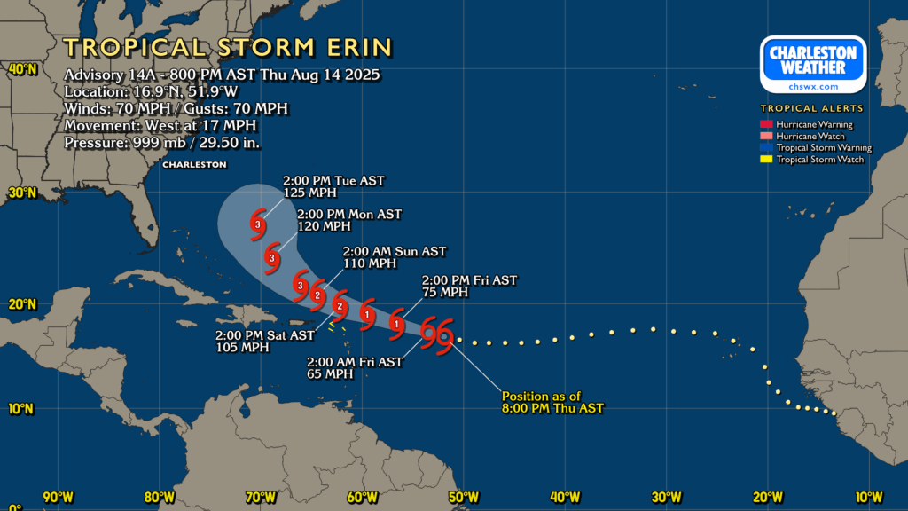
Erin’s strengthened to a 70 MPH tropical storm today, with Tropical Storm Watches now up for parts of the Leeward Islands. The expectation continues to be that Erin will strengthen into a hurricane — potentially a major hurricane — this weekend as it moves west-northwest to northwest. The current forecast indicates a turn more north of northwest as we get into early next week well away from the East Coast, but rip currents and rough surf will continue to be concerns despite the distance between us and the storm. We’ll keep an eye on it and let you know if it turns out to be more than that.
Follow my Charleston Weather updates on Mastodon, Bluesky, Instagram, Facebook, or directly in a feed reader. Do you like what you see here? Please consider supporting my independent, hype-averse weather journalism and become a supporter on Patreon for a broader look at all things #chswx!