Friday & the weekend: Heavy rain expected, Flood Watch through Sunday morning
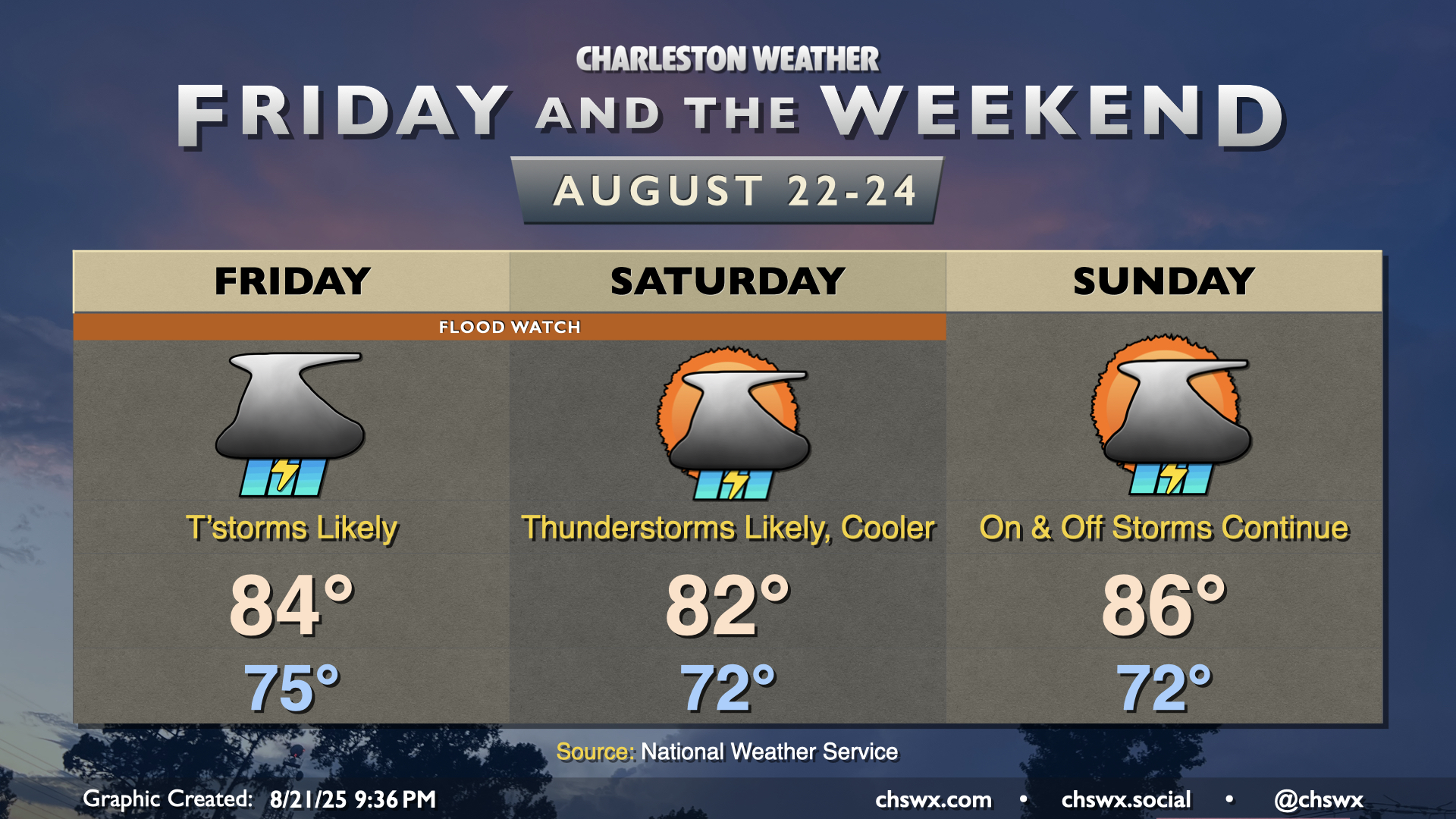
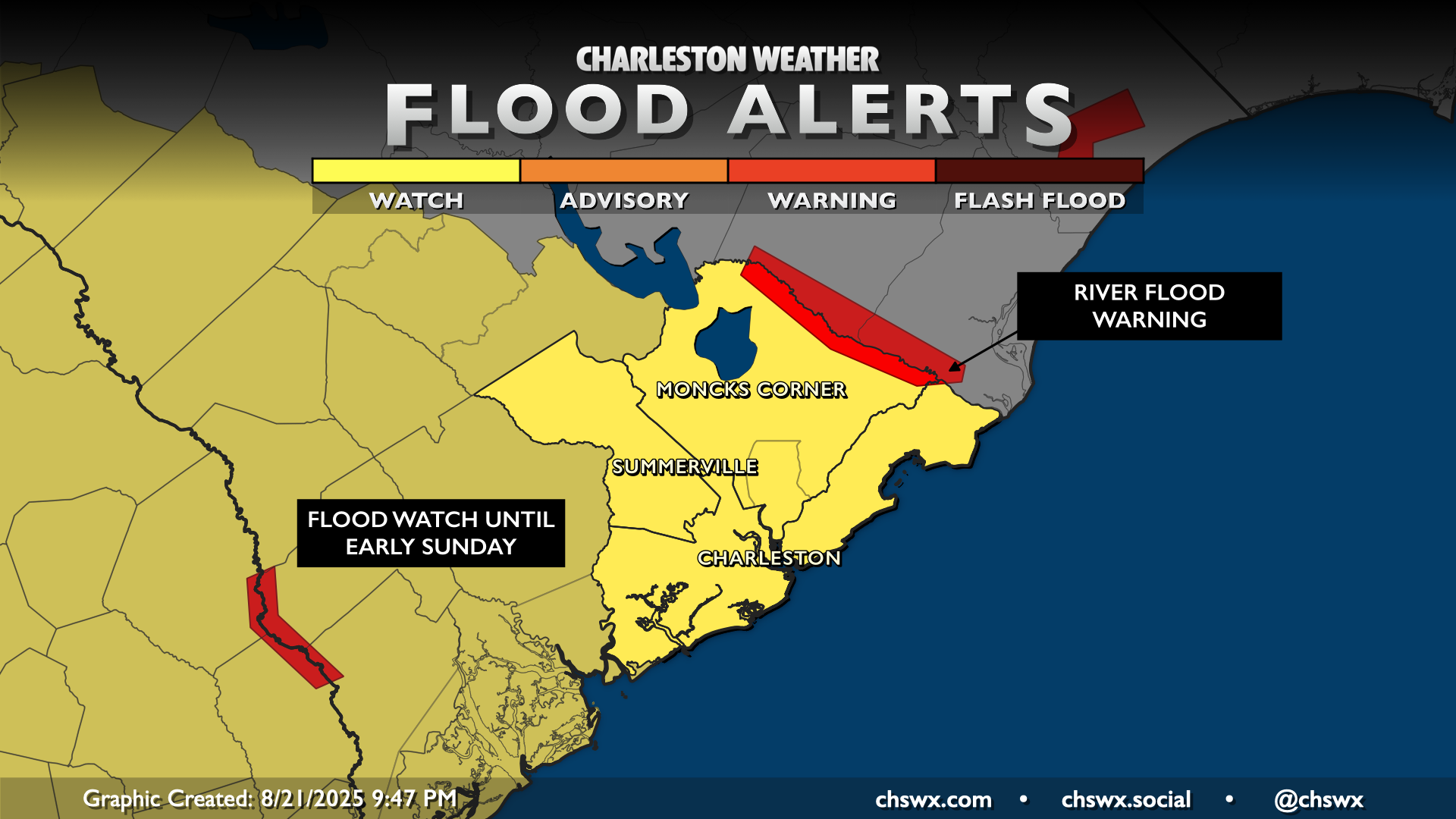
Friday and the weekend will be on the unsettled side as a front stalls out nearby. Waves of low pressure developing along the front will help to tap into resurgent tropical moisture, and given how soggy it’s been this month, it won’t take terribly much for flooding to develop. Thus, a Flood Watch will go into effect at 8am Friday, lasting into late Saturday night/early Sunday morning. We’ll want to pay close attention around the evening high tides on Friday and Saturday, as water levels in Charleston Harbor will remain elevated in the wake of Hurricane Erin. Salt water flooding looks like a good bet, and any heavy rain on top of that would cause widespread issues in downtown Charleston. Keep an ear out for flood alerts from the National Weather Service, especially for Flash Flood Warnings, as they may become necessary over the next few days.
The upside to this is that temperatures will run below normal. Highs on Friday should only top out in the mid-80s, while Saturday’s high may only climb to the low 80s. We’ll warm up a little on Sunday as the periods of heavy rain should taper off, but highs in the mid-80s still run a few clicks below the normal high of 89° this time of year.
Tropics: Three areas of interest, but no imminent concerns for the Lowcountry
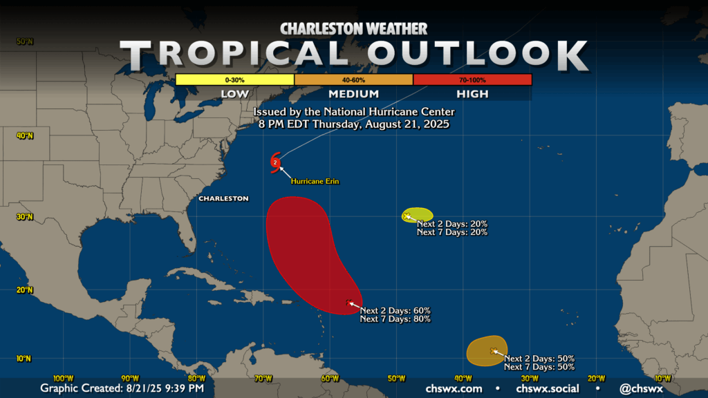
Hurricane Erin will continue to accelerate northeastward and away from the Eastern Seaboard over the next couple days. From there, the most likely area to develop is approaching the Leeward Islands; it’s got a 60% chance to do that over the next couple days and an 80% chance to develop within the next seven. This storm looks to recurve northward well east of the continental US, but may become a problem for Bermuda next week.
Elsewhere, a second area roughly halfway between the Cabo Verde Islands and the Leeward Islands has a 50% chance of becoming a short-lived depression, but it will move into unfavorable conditions thereafter. Finally, a third area around 50°W and 30°N has a small chance of turning tropical, but it’s moving into drier air which will hurt its chances. It, too, poses no threat to us here at home.
Follow my Charleston Weather updates on Mastodon, Bluesky, Instagram, Facebook, or directly in a feed reader. Do you like what you see here? Please consider supporting my independent, hype-averse weather journalism and become a supporter on Patreon for a broader look at all things #chswx!