Tuesday: Dewpoints drop further
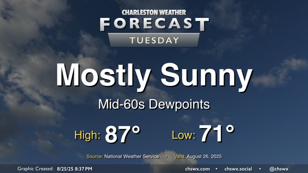
Dewpoints will continue to fall on Tuesday as drier air filters into the area, making for a comfortably warm day with plenty of sunshine to be had. We start the day in the low 70s, warming to the mid-to-upper 80s in the afternoon with just some fair weather cloud cover to be had. All in all, a welcomed nice day after yet another deluge in Mt. Pleasant on Monday.
Rest of the work week: Unsettled pattern returns, but cooler-than-normal temperatures persist
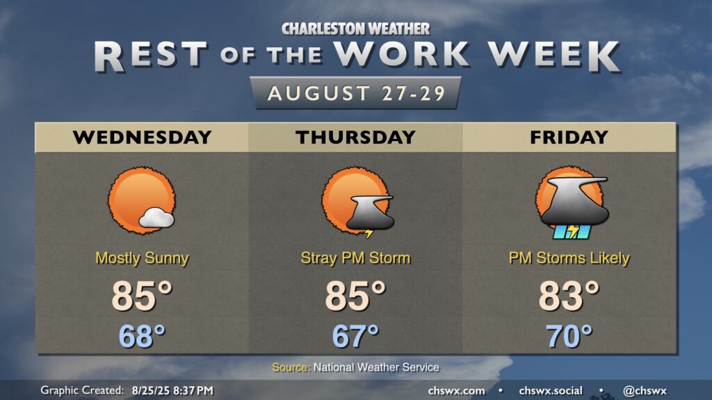
We look to get one more rain-free day in on Wednesday before unsettled conditions return to the picture by the weekend courtesy of some energy moving out of the Midwest. There’s still some differences within the model suite as far as how far north the energy gets, but it does look like there will be at least a little elevated storm chances heading into Labor Day Weekend, unfortunately. However, temperatures remain comfortable, with highs in the low to mid-80s each afternoon after starts in the mid-to-upper 60s to around 70° each morning. We’ll see how the rain chances pan out with subsequent model runs, but for now, don’t totally torch your Labor Day plans, just make sure that you have an indoor Plan B just in case.
Follow my Charleston Weather updates on Mastodon, Bluesky, Instagram, Facebook, or directly in a feed reader. Do you like what you see here? Please consider supporting my independent, hype-averse weather journalism and become a supporter on Patreon for a broader look at all things #chswx!