Friday & Labor Day weekend: Cooler-than-normal temperatures persist with an uptick in storm chances
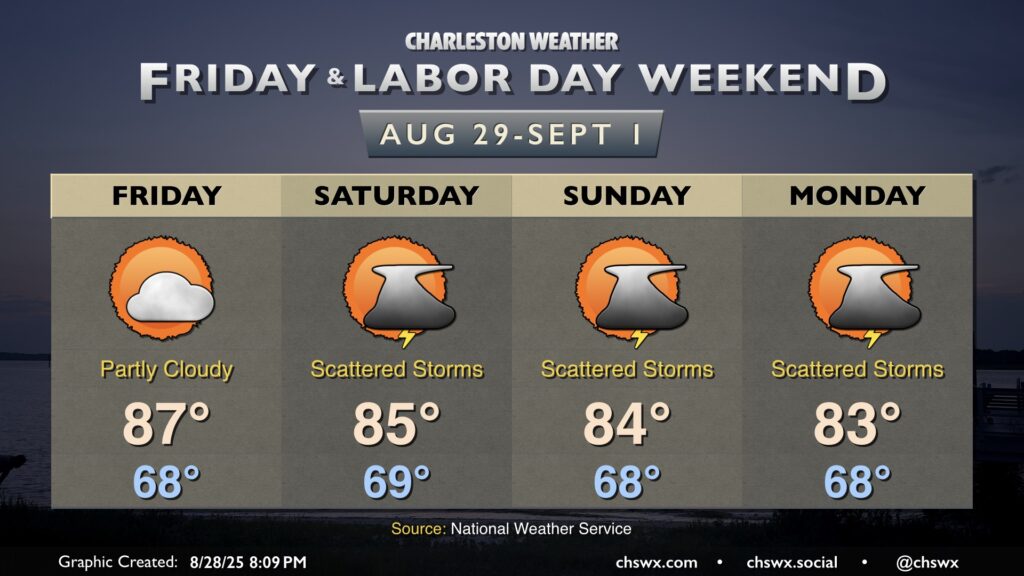
Friday is looking a little warmer but should remain rain-free as high pressure remains the main weather driver for at least one more day. Temperatures start in the upper 60s, warming to the mid-to-upper 80s in the afternoon under partly cloudy skies. An uptick in cloud cover and maybe a stray shower or two could accompany the seabreeze in the afternoon, but guidance keeps the majority of the area dry.
Shower and thunderstorm chances kick up a little bit for the weekend, though the trend has been a bit drier overall as high pressure to the north keeps the better rain chances further south. Still, waves of low pressure should at least kick up scattered coverage across the area especially in the afternoons, but it doesn’t look like a washout, and it will be a far, far cry from last weekend’s deluge. Temperatures will continue to run below normal; expect highs in the mid-80s each afternoon after starting each day in the upper 60s. It won’t feel much like summer as we unofficially bring it to a close, but it should still at least feel fairly pleasant when storms aren’t around.