Friday & the weekend: 90s return; rain holds off until Sunday
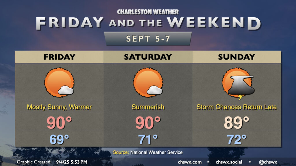
Warmer and a little more humid air will return to the area Friday as winds go more southerly. With high pressure remaining in control for a few more days, though, we’ll stay largely quiet weather-wise this weekend before a front starts to affect the area later Sunday.
Temperatures Friday will start a few degrees warmer than they did on Thursday, with lows bottoming out around 70°, give or take a degree or two. We’ll warm to around 90° in the afternoon under mostly sunny skies. Dewpoints will mix down to the mid-to-upper 60s, keeping heat indices relatively in check, so no real worries there.
We’ll see more of the same on Saturday, which looks to be generally a carbon copy of Friday. Warm and slightly humid conditions will continue, with plenty of sunshine throughout the day. Heat indices will once again top out just a degree or two above the air temperature, which is certainly manageable.
Cloud cover will begin to increase Saturday night as a front draws closer to the area. We’ll have a bit more in the way of cloud cover on Sunday as a result, but right now it looks like the better shower and storm chances will hold off until later Sunday afternoon into the evening. We’ll keep an eye on this timing, but for now, don’t expect a full washout on Sunday by any stretch — good news for local farmers markets, which have been struggling with the nasty weekend weather as of late. Temperatures top out in the upper 80s, running a touch cooler owing to the cloud cover.
Below-normal temperatures return to the area next week, with isolated to scattered storm chances each afternoon as a coastal trough lingers.
Tides: Coastal flooding risk increases starting Friday evening
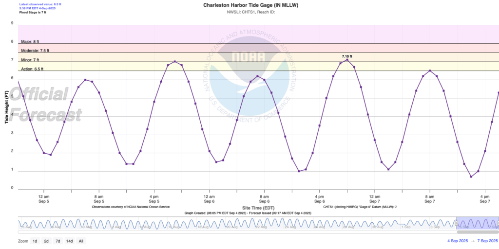
The increasingly full moon and persistent onshore flow will continue to drive tides upward with each evening high tide, and they should start to touch flood stage beginning Friday evening. Minor flooding looks to be possible with each evening high tide through the weekend, with astronomical tide levels peaking on Sunday.
Tropics: Depression likely to form by the weekend in the central Atlantic
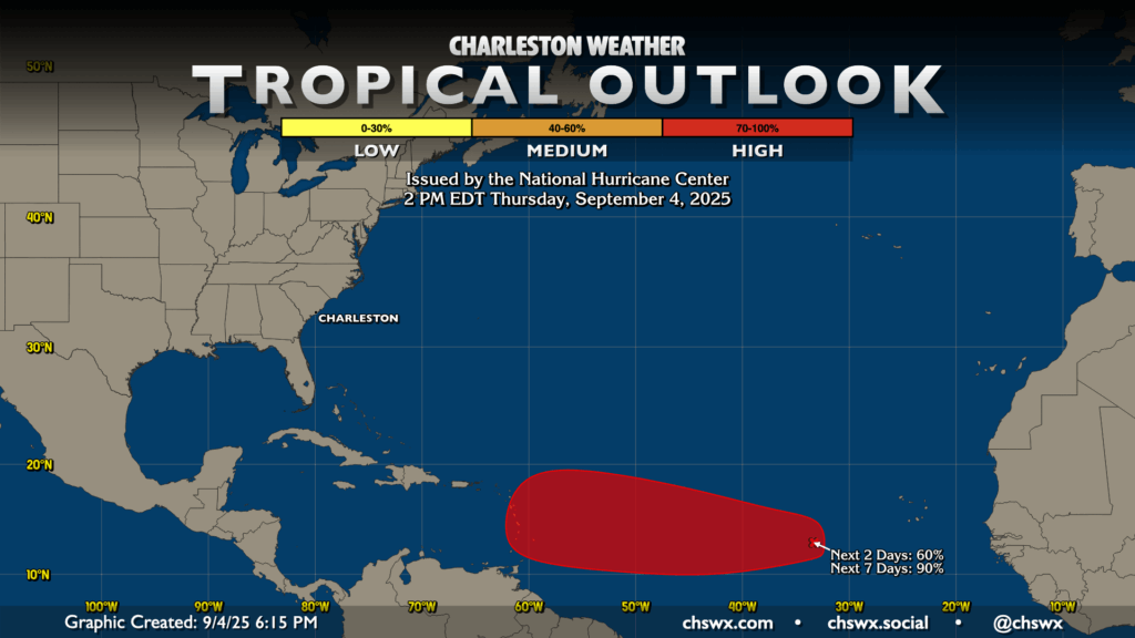
The Atlantic basin should have its next tropical depression by the weekend. Odds are up to 60% for the next two days, with a virtual lock over the next seven days (90%) for development. From there, it’ll move slowly westward across the Atlantic, perhaps approaching the Leeward Islands by next week. We’ve got at least a week and a half to continue to watch this one, so just stay tuned to forecast updates for now. We’ll let you know if it’s anything to worry about.
Follow my Charleston Weather updates on Mastodon, Bluesky, Instagram, Facebook, or directly in a feed reader. Do you like what you see here? Please consider supporting my independent, hype-averse weather journalism and become a supporter on Patreon for a broader look at all things #chswx!