Sunday: Storms return in the afternoon
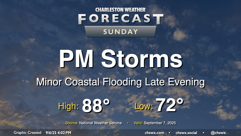
After a few welcome rain-free days, shower and storm chances return to the forecast for Sunday as a cold front moves into the area. We’ll start the day in the low 70s, working our way into the upper 80s in the afternoon before showers and storms kick off. Some rain could be heavy at times, and lightning may be an issue particularly inland where some stronger storms may be possible. It won’t be an all-day rainout, thankfully, but you’ll want to have your indoor plans ready to go if thunderstorms approach.
Isolated salt water flooding may also be a concern around the 7:47 PM high tide. The current total water level forecast brings the tide right to around 7′, which may be enough to cause a little flooding on the most vulnerable roads in downtown Charleston. The risk for coastal flooding around times of high tide increase throughout the first part of the week with the combination of the full moon, lunar perigee, and northeasterly winds in the wake of Sunday’s front, so stay tuned for Coastal Flood Advisories from the National Weather Service.
Tropics: Development chances in the Atlantic drop sharply
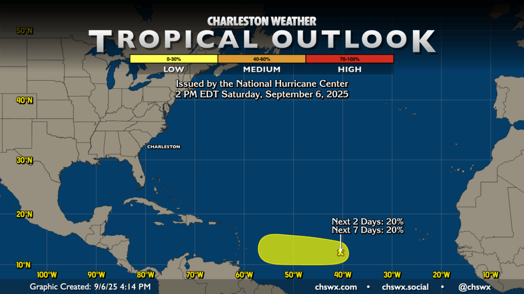
Invest 91L, a disturbance that is around 40°W and 13°N in the Atlantic, was well on its way to potentially becoming a tropical depression by this weekend. Things have changed, though, as the environment surrounding the storm has become much more hostile thanks to a lot of dry air. This has knocked the NHC probability for development down to about 20% over the next few days. We’ll continue to keep an eye on the wave just in case, but otherwise, there are no worries in the Alantic — honestly remarkable for early September! (Not that we’re complaining or anything.)
Follow my Charleston Weather updates on Mastodon, Bluesky, Instagram, Facebook, or directly in a feed reader. Do you like what you see here? Please consider supporting my independent, hype-averse weather journalism and become a supporter on Patreon for a broader look at all things #chswx!