The week ahead: Cooler than normal temperatures with an elevated coastal flooding risk
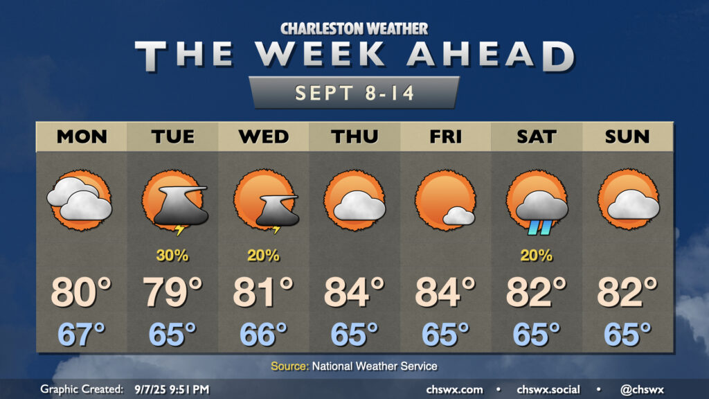
A front which helped stir up another round of heavy rain and flooding in downtown Charleston on Sunday will clear the area overnight into early Monday, yielding a week of comfortable temperatures with occasional slight shower and storm chances.
Rain chances will shut off overnight Sunday into early Monday morning as high pressure builds in from the north, ushering in cooler and drier air. It’ll be a bit breezy behind the front, with northeast winds gusting to 20-25 MPH at times. We’ll start the day in the mid-to-upper 60s, with highs only warming to about 80° in the afternoon with mostly cloudy skies expected.
A few showers and maybe a storm may kick up primarily near the coast on Tuesday, but it should otherwise be another quiet and relatively cool day. Highs will peak in the upper 70s to around 80° in the afternoon as gusty northeasterly winds continue to blow. High pressure begins to weaken a little on Wednesday, which should help bring the winds down a little. Highs Wednesday top out in the low 80s with a slight thunderstorm chance.
The rest of the work week will run a little warmer with a little more in the way of sunshine expected, but we’ll still see temperatures run a little below normal. We may see a shower or two on Saturday with increased cloud cover capping highs in the low 80s. Otherwise, though, a comfortable week lies ahead.
Coastal flooding expected around high tides
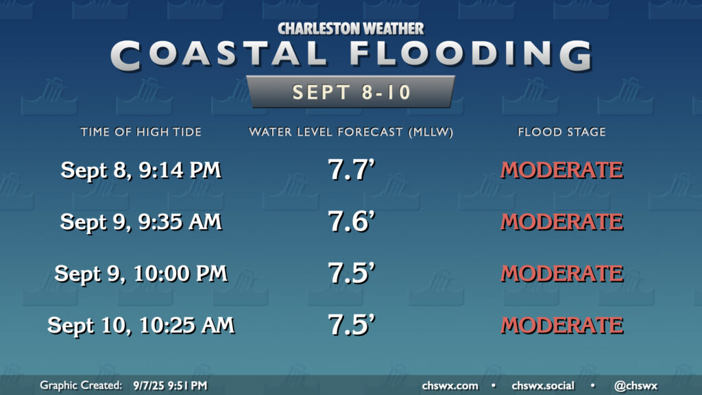
The northeasterly winds and upcoming lunar perigee will be responsible for several rounds of minor to moderate coastal flooding over the next few days, especially starting with Monday evening’s high tide. Water levels Monday evening should peak around 7.7′ MLLW, which will be high enough to close plenty of roads. Thankfully it won’t be taking place during the commute, nor will it take place with heavy rain in the area. But still, the tide could be potentially disruptive.
We may not get quite as lucky Tuesday morning, with another round of moderate coastal flooding expected with the 9:35am high tide. More minor to moderate coastal flooding is expected with the 10pm high tide Tuesday as well as the 10:25am high tide Wednesday. That’s as far as the total water level forecast goes to this point, so it’s conceivable we may have a few more rounds of coastal flooding heading toward the rest of the week. Stay tuned for Coastal Flood Advisories from the National Weather Service.
Tropics: Don’t say the Q-word
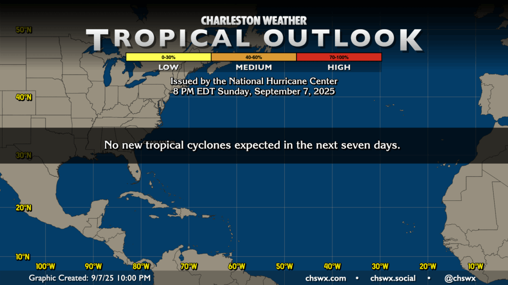
We are just a few days away from the climatological peak of hurricane season (September 10), but there’s not much to speak of in the Atlantic right now with a lot of dry, sinking air and shear. We’ll enjoy the break, but we also know that this can change on a dime. There’s plenty of season left, and it’s still important to stay vigilant, but we also should enjoy these lulls wherever we can get them!
Follow my Charleston Weather updates on Mastodon, Bluesky, Instagram, Facebook, or directly in a feed reader. Do you like what you see here? Please consider supporting my independent, hype-averse weather journalism and become a supporter on Patreon for a broader look at all things #chswx!