Tuesday: Northeast breeze persists, keeping us on the cooler side of normal
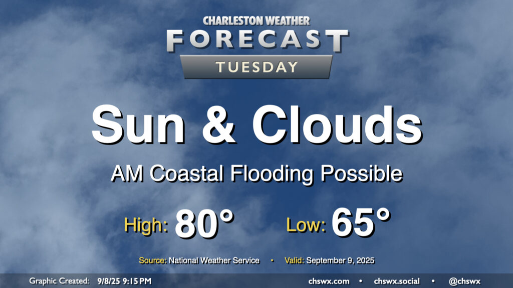
Another quiet weather day is ahead as high pressure wedges across the area from the northeast. Expect a mix of sun and clouds with comfortable temperatures. We start the day in the mid-60s, warming to about 80° in the afternoon. It’ll be a bit breezy, with winds gusting around 15-20 MPH especially near the coast. These northeasterly winds will continue to drive tidal departures in Charleston Harbor above flood stage, and we should see minor to moderate flooding with the 9:35 AM high tide. Some flooding may have impacts on the tail end of the commute, so be prepared for delays if downtown is your destination.
Rest of the work week: Turning a little warmer, but still pleasant
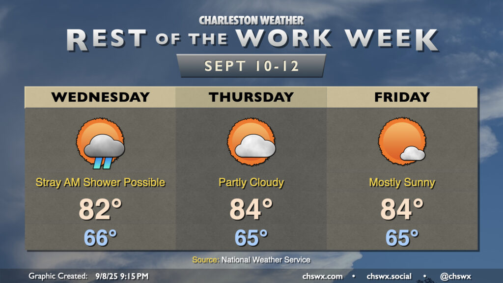
The rest of the work week will continue to feature high pressure and cooler-than-normal temperatures, though a little sunshine for Thursday and Friday will help warm temperatures back into the mid-80s. A stray morning shower will be possible Wednesday near the coast, but otherwise, we look to stay rain-free through the end of the work week.
The only fly in the ointment will be the continued risk for minor to moderate coastal flooding around times of high tide through at least Thursday morning as northeasterly winds and the lunar perigee continue to drive higher water levels over the next several days. Stay alert for Coastal Flood Advisories from the National Weather Service.
Follow my Charleston Weather updates on Mastodon, Bluesky, Instagram, Facebook, or directly in a feed reader. Do you like what you see here? Please consider supporting my independent, hype-averse weather journalism and become a supporter on Patreon for a broader look at all things #chswx!