Thursday: Another partly cloudy and warm day
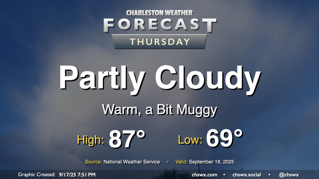
Another warm day is ahead for Thursday as high pressure generally remains in control with winds coming a bit more out of the west and southwest. Temperatures Thursday start much warmer than they did on Wednesday, with lows in the upper 60s to around 70° expected. We’ll warm to the mid-to-upper 80s in the afternoon under generally partly cloudy skies. A stray shower or storm is possible well inland, but the vast, vast majority of us will stay rain-free.
Rest of the work week: Still warm; slight shower and storm chances return Sunday afternoon
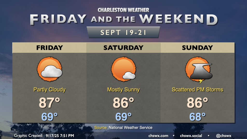
We stay warm heading into Friday and the weekend with high pressure remaining in control. It’ll get reinforced over the weekend, taking temperatures down a couple degrees, but still a click above normal for this point in the year. Friday and Saturday look rain-free, but as a coastal trough develops on Sunday, a stray shower or storm will be possible in the afternoon, particularly near the coast. However, we’re not looking at a washout — just be ready to bring outdoor plans indoors if a storm threatens.
Follow my Charleston Weather updates on Mastodon, Bluesky, Instagram, Facebook, or directly in a feed reader. Do you like what you see here? Please consider supporting my independent, hype-averse weather journalism and become a supporter on Patreon for a broader look at all things #chswx!