Friday & the weekend: Turning stormy as we watch the tropics
A front and upper-level low will send weather downhill as we get into Friday afternoon and the rest of the weekend, though that won’t be the main weather story, methinks, as we monitor the disturbance currently known as Invest 94L in the tropics for possible development and subsequent impacts next week.
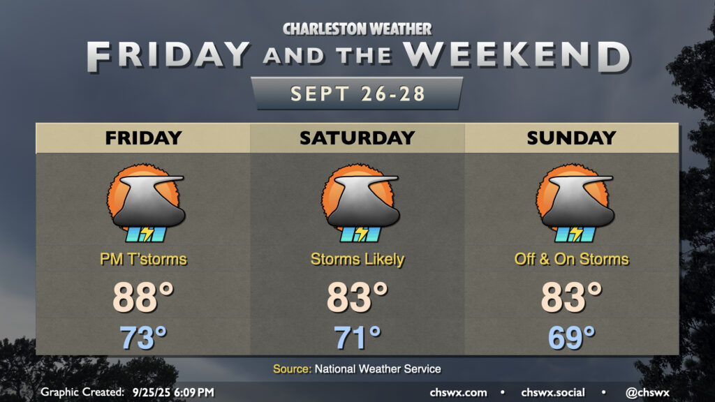
First, though, we’ve got this weekend’s rain. It’s got nothing to do with anything tropical and everything to do with an upper trough that’ll drive a cold front into the area on Friday. We start the day rain-free, which will help temperatures warm into the mid-to-upper 80s, but that’ll change as we head into the afternoon as the front draws closer to the area. High-resolution guidance indicates generally scattered to numerous showers and thunderstorms moving from south to north across the area with periods of heavy rain possible at times. We’ll keep this going into Saturday as the front slowly crosses the area and stalls out just offshore, with the potential for isolated bouts of heavy rain. A Marginal Risk of excessive rainfall is in place across the area for Saturday and continues into Sunday with the stalled front and continued feed of moisture keeping scattered to numerous storms in the forecast, especially with daytime heating in the afternoons.
Tropics: Watching 94L closely for potential early-to-mid-week impacts
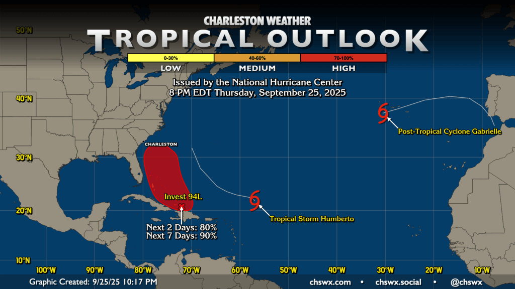
The main weather headline today, though, has been the tropical disturbance known as Invest 94L. It is getting better organized this evening, and should become a tropical cyclone before too much longer. NHC gives it an 80% chance to develop in the next two days, and a 90% chance to develop within the next seven. Model guidance is unanimous at this point in developing a tropical cyclone from 94L, but much uncertainty remains as far as the upper-air setup and the storm’s interaction with Tropical Storm Humberto, which is expected to become a major hurricane in the next few days but not directly affect any landmasses.
The reason we in the weather enterprise are starting to sound the alarm a bit today is that when this does form, we may only have a couple days of lead time before we could begin to feel impacts along the Southeast Coast. Where those impacts take place and how strong those impacts are remains very much in question, and will all be governed by the complexities of the upper-level trough (which may become cut off and meander to our west, helping to steer the storm closer to the coast) as well as how close and strong Humberto ultimately becomes, which will have impacts on how much shear 94L’s tropical cyclone will have to endure to stay organized and strengthen. (Generally speaking, the less shear working on the system, the better organized — and thus stronger — it becomes.)
Track guidance has shown unusually good — but certainly not unanimous — agreement today in steering this storm into the Carolina coast sometime late Monday into Tuesday. (Which Carolina is very much up in the air; track guidance has corrected a little east after a big shift west this morning.) However, this has the potential to still change quite a bit between now and then as the models can struggle, sometimes mightily, with storms that haven’t formed yet. This can cause some big swings in model solutions at times. Hurricane Hunter flights as well as six-hourly soundings from NWS offices across the eastern half of the continental US will help the models get more observational data to work with, which should yield a more accurate forecast once the center develops. We’ll be looking for consistency between different models as well as run-to-run consistency within each model to improve confidence in the forecast over the next few days.
For now, we can expect an uptick in surf, rip currents, and perhaps some coastal flooding concerns as we get into next week — pretty much a given with Humberto, much less 94L, out there. More specific impacts such as winds, rainfall, tornadoes, and storm surge are much less certain at this point, but are things that some of us may contend with next week. So, take advantage of the next few days to ensure your hurricane kit is stocked and ready to go, you’ve reviewed your emergency plan, and are aware of your evacuation zone in the as-yet-unlikely event of an evacuation. Do these things while monitoring trustworthy sources of information over the next few days and you’ll be just fine.
Follow my Charleston Weather updates on Mastodon, Bluesky, Instagram, Facebook, or directly in a feed reader. Do you like what you see here? Please consider supporting my independent, hype-averse weather journalism and become a supporter on Patreon for a broader look at all things #chswx!