Thursday: Another gorgeous day
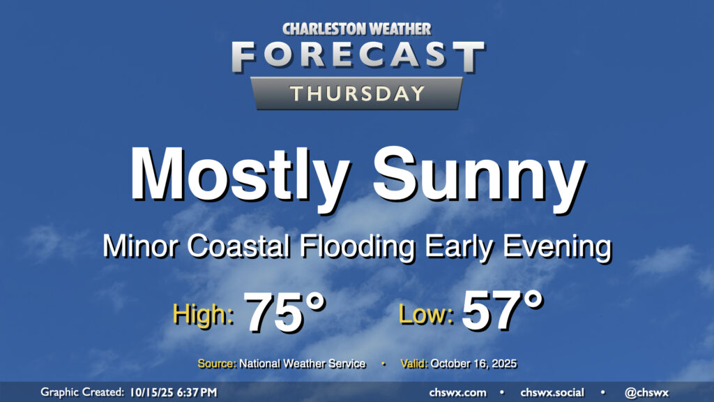
Mother Nature’s apology for the nor’easter continues Thursday with another day of comfortable temperatures and plenty of sunshine expected. A weak, dry front moves by early in the day, and so we should see temperatures start and peak a little cooler than we did on Wednesday. Expect lows in the mid-to-upper 50s warming to the mid-70s under mostly sunny skies. Winds will swing around to the northeast and pick up a little bit, and this could drive some minor coastal flooding with the early evening high tide cycle. A Coastal Flood Advisory is possible, but impacts beyond the most vulnerable locations downtown will be minimal.
Friday & the weekend: Temperatures bottom out before warming as lots of sunshine continues
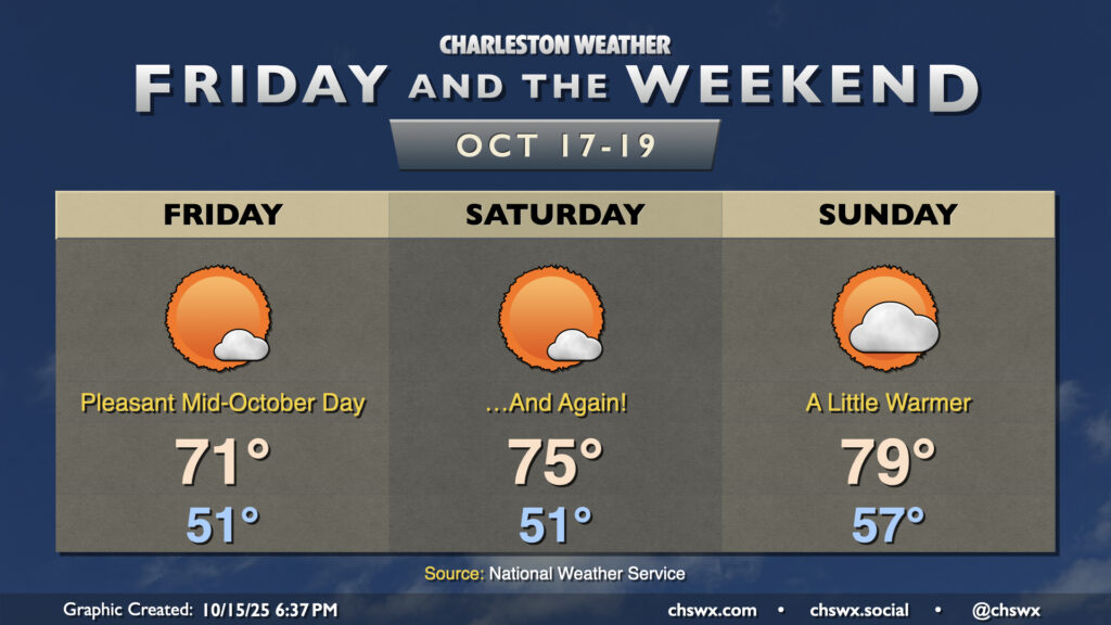
Our weather winning streak continues for Friday and the weekend as high pressure remains the dominant weather feature through Sunday. Temperatures will run even cooler on Friday than they did Thursday, with lows in the low 50s warming to the low 70s in the afternoon despite plenty of sunshine. We’ll get off to a similarly cool start Saturday, but highs will rebound into the mid-70s. The warming trend continues Sunday as high pressure shifts offshore, with lows in the upper 50s warming to highs near 80° in the afternoon. A stray shower may be possible very late Sunday night into early Monday morning as another front moves by, but moisture is limited and shouldn’t be too much of an issue.
Follow my Charleston Weather updates on Mastodon, Bluesky, Instagram, Facebook, or directly in a feed reader. Do you like what you see here? Please consider supporting my independent, hype-averse weather journalism and become a supporter on Patreon for a broader look at all things #chswx!