The week ahead: Quiet and seasonable weather continues
Another generally quiet week of weather lies ahead as high pressure remains the primary weather driver across the Southeast with a reinforcing shot of cooler air for the second half of the week.
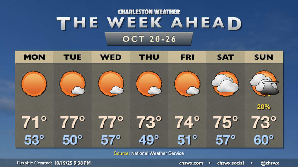
A cold front coming through overnight Sunday into early Monday morning will bring another round of cooler and drier air to the area for Monday, scouring out the briefly humid conditions we felt on Sunday. Temperatures Monday start in the low to mid-50s, warming to the low 70s in the afternoon with basically unfettered sunshine. Tuesday starts around 50°, but the afternoon will run a little warmer as highs peak in the mid-to-upper 70s. Another front gets through late Tuesday into early Wednesday with little fanfare other than a wind shift. Some downslope flow still allows Wednesday to warm into the mid-to-upper 70s in the afternoon, but as high pressure moves further overhead, we’ll have a cooler Thursday, including lows dropping into the upper 40s. Cooler temperatures prevail Friday before high pressure slips offshore this weekend, bringing dewpoints and cloud cover up a bit. There’s a chance we could see a few showers or storms ahead of another cold front on Sunday, but so far there’s no sign of anything approaching a total wash, and I wouldn’t expect that given the generally limited moisture across the area.
Tropics: One area to watch, but no imminent concerns at home

Yes, hurricane season continues: There’s one area of interest in the southern Caribbean that has a high chance of developing into a tropical cyclone this week as it moves westward. As usual at this stage, there’s high uncertainty about how strong it gets and where it ends up. There does appear to be the risk for some impacts to Cuba, Jamaica, Hispaniola, and Puerto Rico later this week into early next, but we’ll keep an eye on it. Ultimately, though, this does not appear to be a storm we need to worry about at this juncture, and the overall pattern strongly supports us missing out on direct impacts, with perhaps just some waves and rip currents to contend with at some point in the next couple weeks.
Follow my Charleston Weather updates on Mastodon, Bluesky, Instagram, Facebook, or directly in a feed reader. Do you like what you see here? Please consider supporting my independent, hype-averse weather journalism and become a supporter on Patreon for a broader look at all things #chswx!