Friday & the weekend: Seasonable conditions continue
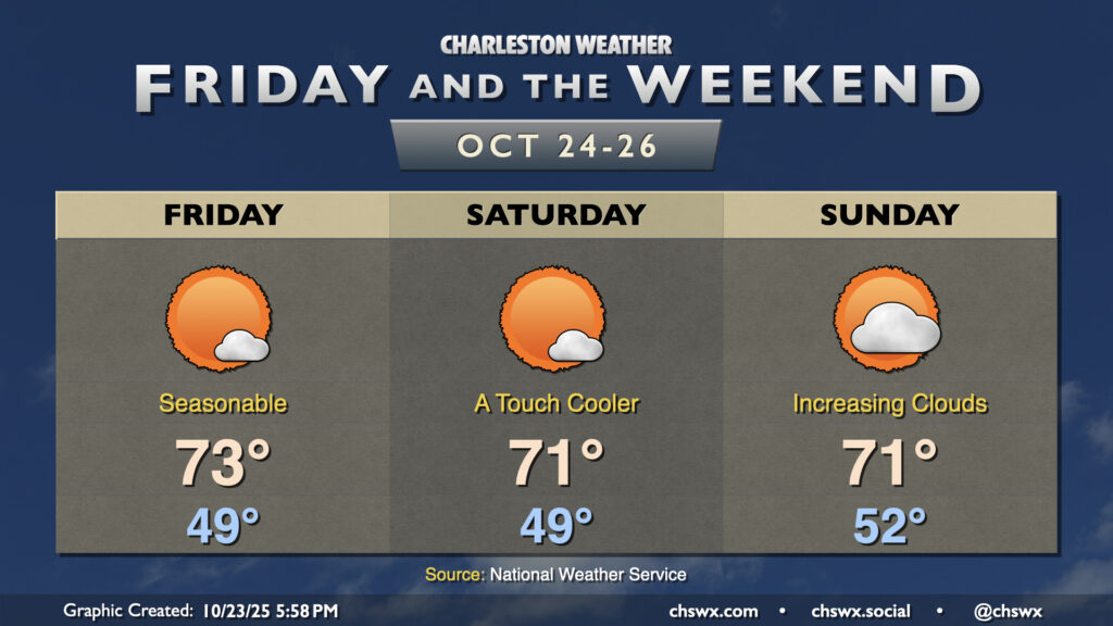
Expect generally quiet weather and seasonably cool temperatures to continue for Friday and the weekend. Dry high pressure remains in control for Friday with temperatures cooling to the upper 40s by morning, warming to the low-to-mid-70s in the afternoon with just a few clouds. High pressure then begins to wedge into the area over the weekend, bringing with it slightly cooler temperatures for Saturday. Moisture return ahead of the next storm system starts to kick in on Sunday, with dewpoints rising throughout the day contributing to a bit more in the way of cloud cover ahead of what looks to be an unsettled first half of the work week next week as low pressure heads up the coast.
Tropics: Tropical Storm Melissa meanders in the Caribbean, may become a major hurricane
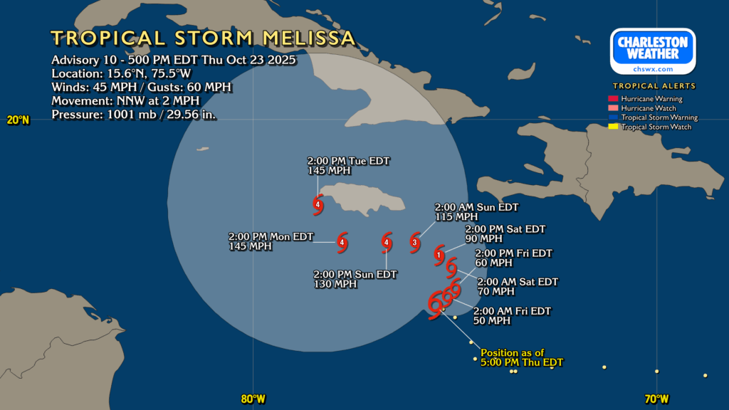
Hurricane season continues with Tropical Storm Melissa in the Caribbean. Melissa is drifting NNW at 2 MPH, and should meander while strengthening heading into the weekend. It’s expected to become a hurricane on Saturday, and may become a formidable, slow-moving Category 4 storm by Sunday. This could be a particular issue for Jamaica, Cuba, and Hispaniola in particular as the slow-moving storm just hangs around for several days, perhaps not catching its ride out of there until Wednesday or Thursday. As for where it ultimately goes, the ensembles are strongly favoring a track that spreads at least some impacts to the Bahamas before heading out to sea, perhaps kicking some waves our direction but little else. Hurricane season continues until November 30.
Follow my Charleston Weather updates on Mastodon, Bluesky, Instagram, Facebook, or directly in a feed reader. Do you like what you see here? Please consider supporting my independent, hype-averse weather journalism and become a supporter on Patreon for a broader look at all things #chswx!