Weekend forecast: Generally nice, but changes are on the way
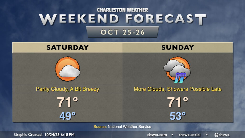
Generally speaking, we can expect good weather this weekend (especially on Saturday) with a wedge of high pressure building southward through the Carolinas into Georgia. This will lead to breezier conditions for the weekend as northeasterly winds kick up, and temperatures will run a couple clicks lower with cooler air moving in at the surface. Moisture will also start to overrun the wedge, and that will bring a gradual increase in dewpoints and cloud cover as low pressure develops in the Gulf. This low pressure system may bring us some showers later Sunday, and look to make for a soggy Monday.
Saturday’s lows will once again begin in the upper 40s (with some mid-40s inland), warming to the low 70s in the afternoon under partly cloudy skies. Cloud cover will continue to thicken on Sunday as moisture return continues; this will lead to a warmer start in the mid-50s before highs peak around 70-71° once again under mostly cloudy skies. Showers and maybe even some rumbles of thunder will be possible beginning Sunday evening, so keep that in mind as you make your weekend plans.
Looking ahead: Sweater weather for the last week of October
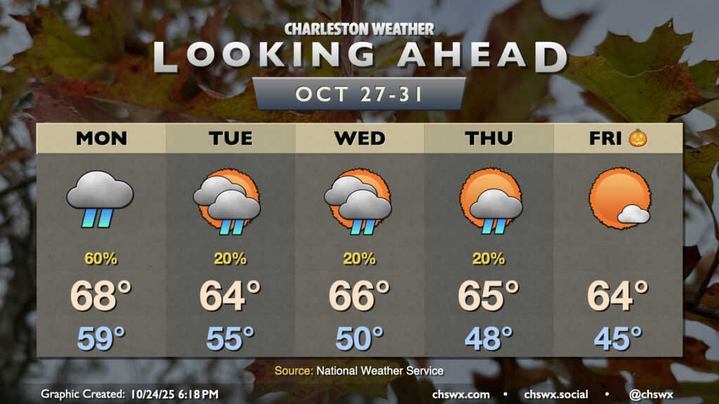
Low pressure will develop offshore Monday and move up the coast, bringing the best rain chance of the week along with it. Lows in the upper 50s will only warm to the upper 60s at best given the cloud cover and expected showers. How much rain falls ultimately depends on how close the low gets to our neck of the woods; it’ll be the difference between a quarter-to-half-inch of rain and over an inch, especially closer to the coast.
The low pulls away Tuesday, but we’ll deal with some lingering moisture through Thursday that, combined with some mid-level energy, could produce some shower chances during that time before drier conditions look to set in for Halloween on Friday. The most notable part of the forecast, though, may be the high temperatures — a solid stretch of mid-60s is in the offing, even with improving conditions heading into next weekend (the first of November, no less). Sweaters and hoodies at the ready!
Tropics: Melissa to bring significant impacts to Jamaica
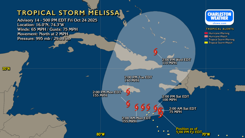
Finally, slow-moving Tropical Storm Melissa continues to get better organized and should become a hurricane by tomorrow. The NHC forecast is certainly concerning for Jamaica in particular, with hurricane conditions possible in Cuba and Haiti as well as Melissa is forecast to intensify to a very strong Category 4 storm. Category 5 intensity is not explicitly forecast, but it is well within the realm of possibility. The bigger story, though, will be very heavy rainfall over the course of several days as the hurricane moves very slowly in the Caribbean before making landfall on Jamaica on Tuesday. From there, it will finally catch a ride to the north and northeast, but not before threatening the Bahamas with hurricane conditions for the middle of next week. Direct impacts from Melissa aren’t expected, but don’t be surprised if the sea is a little angrier next weekend.
Follow my Charleston Weather updates on Mastodon, Bluesky, Instagram, Facebook, or directly in a feed reader. Do you like what you see here? Please consider supporting my independent, hype-averse weather journalism and become a supporter on Patreon for a broader look at all things #chswx!