Tuesday: Another sunny and seasonable day
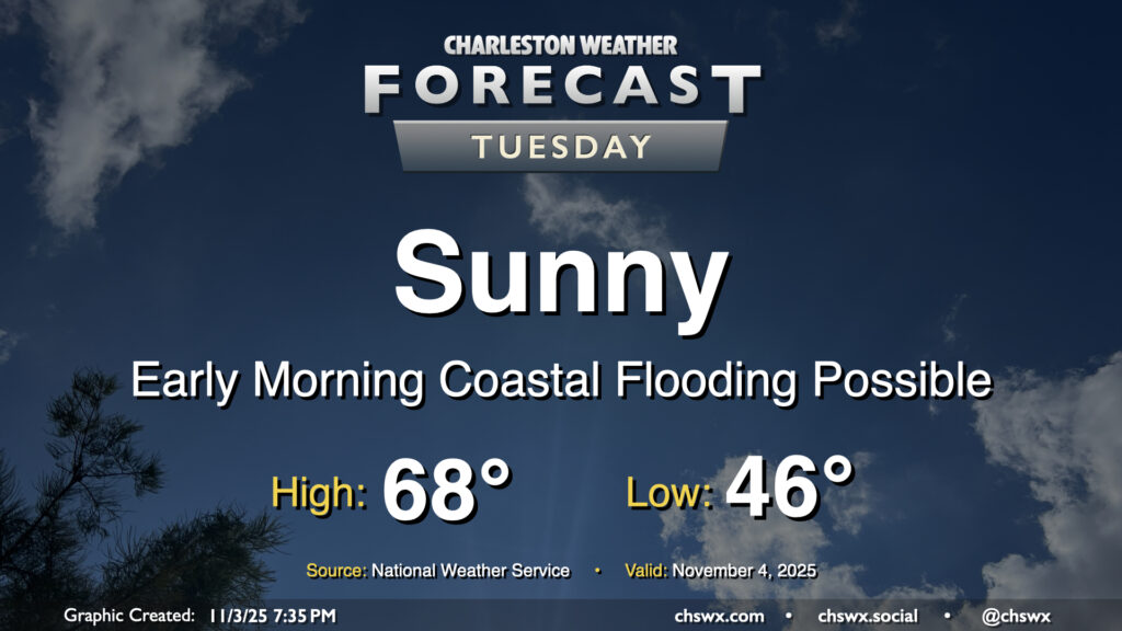
Plenty of sunshine will continue on Tuesday as high pressure builds across the area from the west, keeping northeasterly flow in place which will keep temperatures on the cool side of normal and also help to elevate the morning high tide into minor flood stage. We’ll start the day in the mid-40s, warming to the upper 60s in the afternoon, which will feel quite comfortable with the sun out. The aforementioned northeasterly winds will run generally in the 5-10 MPH range, which will be enough of a breeze to make it feel a little cooler in the shade.
As mentioned, some coastal flooding will be possible between 5-8am as water levels peak in minor flood stage (7-7.2′) with the 6:11 am high tide. This may have limited impacts in the most vulnerable areas of the peninsula, primarily around the Hagood/Fishburne intersection as well as possibly on parts of Lockwood. Be ready to reroute around any closures.
Rest of the work week: More sunshine and warmer temperatures
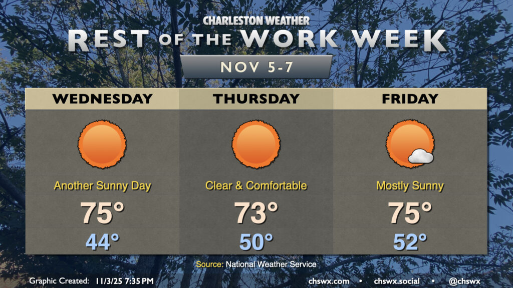
The rest of the work week will feature warming temperatures as we see a little bit more in the way of moisture build back into the area as high pressure slips offshore. Wednesday will feature one more fairly cool morning in the mid-40s, but the mornings will generally run in the low 50s for Thursday and Friday. Highs will generally peak in the mid-70s each day, with a slight cooldown Thursday as a dry front slides through in the morning, kicking winds around to the northeast again as another area of high pressure builds in. There is still the potential for the forecast to turn wetter Friday into Saturday depending on the strength of another front that’ll move by, but for now, dry weather remains the most likely outcome.
Coastal flooding will continue to play a role through the end of the week as the highest astronomical tides of the year take place. Minor to moderate flooding will be possible Wednesday morning, with minor flooding on Thursday. Generally, expect the risk for coastal flooding to peak between 6-9am on Wednesday and Thursday, with the risk window shifting to 7-10am heading into Friday. If downtown is part of your commute, be alert to possible road closures due to flooded roads. Fortunately, the dry forecast and generally unfavorable winds will keep these tides from becoming worse than they are.
Follow my Charleston Weather updates on Mastodon, Bluesky, Instagram, Facebook, or directly in a feed reader. Do you like what you see here? Please consider supporting my independent, hype-averse weather journalism and become a supporter on Patreon for a broader look at all things #chswx!