Thursday: Slightly cooler, but warming back up Friday
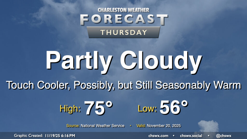
Warm temperatures continue for Thursday, though a nearby front and some more cloud cover will likely preclude temperatures from getting too out of hand. Wednesday’s highs were close to records for the date: 82° at the airport was just a degree shy of the record of 83° set in 1942, while 80° downtown missed the record of 82° set there in 1958. Depending on where the front hangs up, we may yet make another run at records, but the preponderance of the evidence suggests that we’re going to stay in the mid-to-upper 70s on Thursday. The front won’t come with much moisture, so an uptick in cloud cover is about it.
Friday & the weekend: Warmer-than-normal temperatures persist, though a little cooler on Sunday
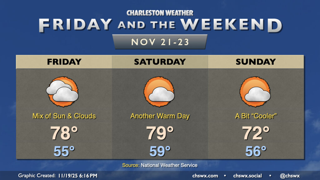
The brief cooldown on Thursday will be short-lived as high pressure shifts offshore and washes out the front over land, turning winds southerly once again and sending highs into the upper 70s to low 80s with a mix of sun and clouds. We’ll stay warm on Saturday ahead of a cold front, with temperatures flirting with 80° one more time before that front gets by early Sunday, which will cool us off a little bit — albeit with highs still running in the low 70s, which remains above normal for this point in November. Partly cloudy skies will remain the rule with a dry forecast expected, though a stray shower may be possible well inland with the frontal passage later Saturday/early Sunday. Don’t count on that, though.
The next shot at some rain arrives Tuesday into Wednesday with another front, but chances remain generally on the low side for now. We’ll wait and see if this rain chance evaporates, too…
Follow my Charleston Weather updates on Mastodon, Bluesky, Instagram, Facebook, or directly in a feed reader. Do you like what you see here? Please consider supporting my independent, hype-averse weather journalism and become a supporter on Patreon for a broader look at all things #chswx!