Tuesday: More clouds, maybe a shower
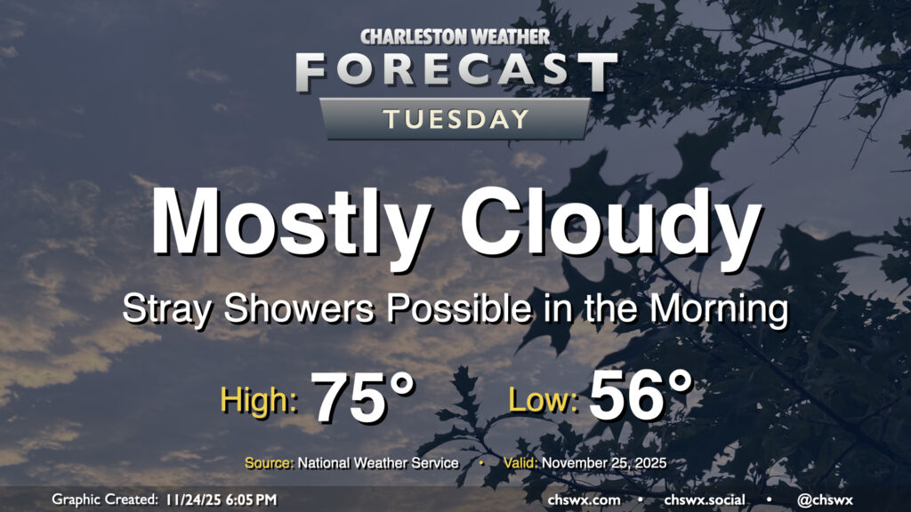
High pressure to our north will be shifting offshore as Tuesday goes on ahead of a storm system moving through the Ohio Valley, allowing a warm front to push northward into the area during the day. Some of us may see a few showers as this warm front moves northward, especially later in the morning and closer to the coast. They’ll be relatively short-lived, clearing the area during the afternoon, and won’t amount to too terribly much rain for those who see any of it at all. It’ll be a mild day once again, with lows in the mid-50s warming to the mid-70s in the afternoon in the wake of the warm front.
Rest of the week: Big Thanksgiving cooldown in store
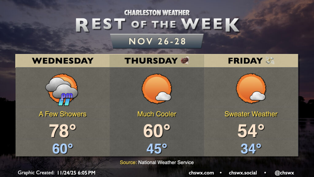
A cold front will swing through Wednesday, bringing a slight chance for a few showers to the area as it passes. Ahead of that front, it’ll be quite unseasonably warm: lows around 60° will warm to the upper 70s under mostly cloudy skies. The front clears the area Wednesday night, ushering in much cooler and drier air just in time for Thanksgiving, which looks to start in the mid-40s and only warming to 60° — Wednesday’s forecast low temperature — in the afternoon under mostly sunny skies. Black Friday looks even cooler, with temperatures falling into the low-to-mid-30s overnight before warming to just the mid-50s despite nearly full sunshine.
The chill continues into Saturday, but a warming trend will commence Sunday, and by Monday high temperatures return to around 70°, with another shot at some unsettled weather to bring some much-needed rain to the area heading into the first week of December.
Follow my Charleston Weather updates on Mastodon, Bluesky, Instagram, Facebook, or directly in a feed reader. Do you like what you see here? Please consider supporting my independent, hype-averse weather journalism and become a supporter on Patreon for a broader look at all things #chswx!