Thanksgiving: Break out the sweaters

One front has come through as of this writing Wednesday evening, with another front hot on its heels to pass through overnight into early Thanksgiving morning. This second front is going to bring in quite the cooldown for the next few days, especially as we get into Friday and Saturday, but Thanksgiving will certainly illustrate the contrast from the past few days: expect lows in the mid-40s to warm to just about 60° in the afternoon, which is just a hair warmer than Wednesday’s morning low! We’ll have plenty of sunshine, though, with no weather worries for the holiday.
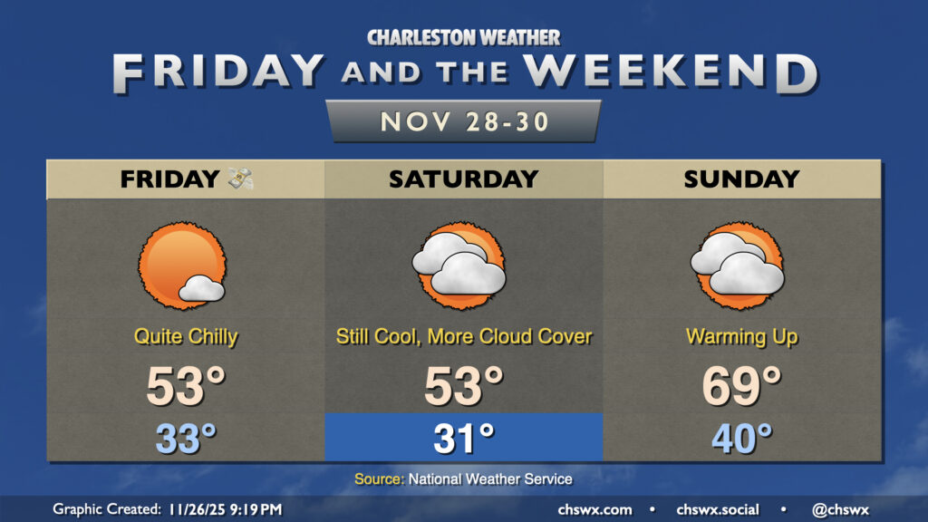
(Black) Friday and the weekend: Quite chilly until Sunday

Unseasonably cool conditions continue Friday and Saturday as we sit on the south and east side of Canadian high pressure. We’ll likely be dealing with frost and freeze conditions on Friday and Saturday mornings, so make sure plants and pets are warm and safe. (Note that since the growing season has ended due to the hard freeze earlier this month, there will be no Frost and Freeze alerts from the National Weather Service until March.) Afternoon highs will top out just in the low-to-mid-50s at best on Friday and Saturday, so keep that warm weather gear ready to go.
Cloud cover will gradually increase as we head into the weekend ahead of the next storm system. High pressure slips offshore later Saturday, and we will find temperatures turning sharply warmer as a result. Sunday starts around 40°, but we warm to the upper 60s to near 70°. Showers associated with the storm system should hold off until late Sunday or Monday as we kick off December on a bit of an unsettled note.
Have a happy and safe Thanksgiving!
Follow my Charleston Weather updates on Mastodon, Bluesky, Instagram, Facebook, or directly in a feed reader. Do you like what you see here? Please consider supporting my independent, hype-averse weather journalism and become a supporter on Patreon for a broader look at all things #chswx!