Tuesday: More sunshine, but quite chilly
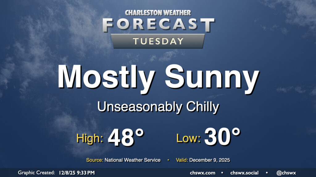
We’ll finally shed the cloud cover that’s punctuated the last several days on Tuesday as high pressure builds in from the northwest. The aforementioned high pressure will drive even cooler and drier air into the area, and we’ll wake up below freezing as a result away from the coast. The northerly breeze will help drive wind chills down into the low to mid-20s during the morning, so be sure to add a layer or two as you head out for the day. The feed of cooler and drier air continues throughout the day, so even with plenty of sunshine, highs will likely not climb out of the upper 40s.
Rest of the work week: Turning warmer, but still cooler than normal
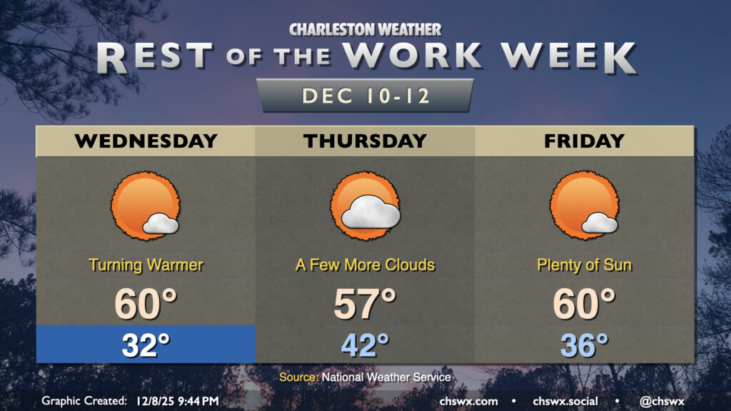
Quiet weather will continue for the rest of the work week as temperatures rebound a bit while also continuing to stay below normal for this point in December. We’ll get off to another freezing start Wednesday morning, but temperatures will rebound nicely to around 60° in the afternoon as high pressure slips offshore. A dry front comes through with a slight uptick in cloud cover for Thursday, but no rain is expected; expect lows in the low 40s to warm to the upper 50s in the afternoon. More sunshine returns for Friday, with lows in the mid-30s warming to around 60° in the afternoon.
The next front arrives over the weekend, but right now it looks like it’ll be a dry passage once again, setting up another shot of cool air for next week.
Follow my Charleston Weather updates on Mastodon, Bluesky, Instagram, Facebook, or directly in a feed reader. Do you like what you see here? Please consider supporting my independent, hype-averse weather journalism and become a supporter on Patreon for a broader look at all things #chswx!