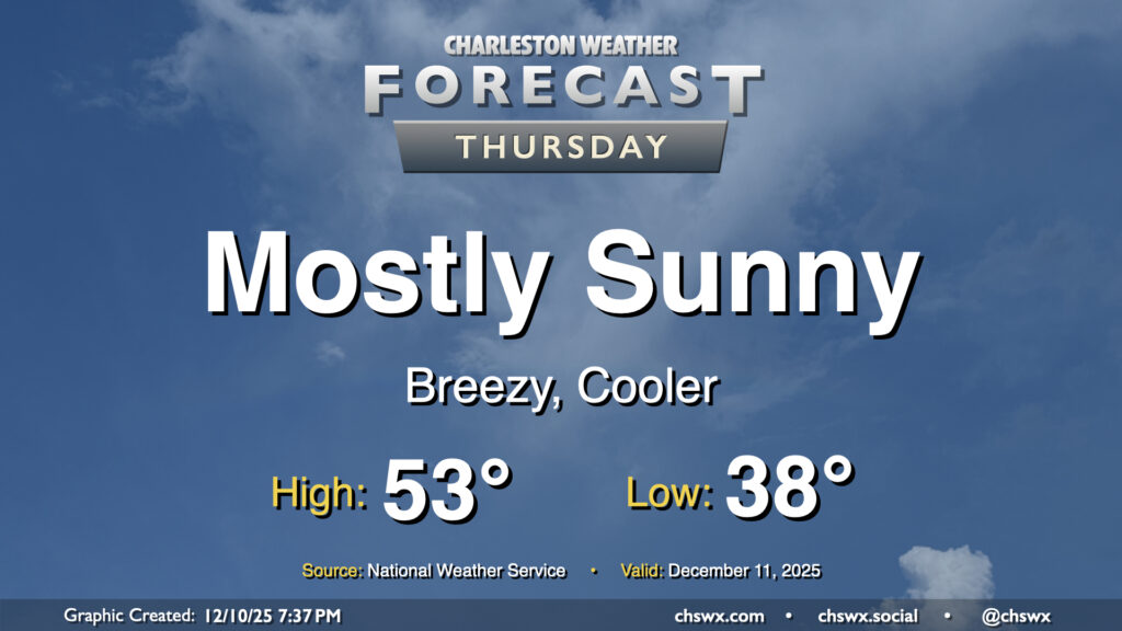
Thursday: Another round of cooler air, minus the freezing fog
Another dry front will come through overnight with a reinforcing shot of cooler air for our neck of the woods, but at least we won’t be starting the day with freezing fog like we did this morning. Freezing fog occurs when fog develops at temperatures below freezing, producing a glaze of ice on surfaces it comes into contact with (generally elevated surfaces). This morning, temperatures fell to the dewpoint of 28°, which aided in its formation and caused quite a few problems on bridges and overpasses, with numerous traffic accidents and closure of both the Don Holt and North Bridges. Freezing fog is incredibly, incredibly rare for this part of the world — in fact, this morning’s Freezing Fog Advisory was the first ever issued for the Charleston metro area, and only the second issued by NWS Charleston, SC (the first one was issued in 2022).
Thankfully, we will not deal with this Thursday morning as temperatures are expected to stay above freezing, generally running in the upper 30s to around 40°. The aforementioned dry front comes through early in the day, and this helps usher in another shot of cooler air that’ll keep things breezy and chilly Thursday afternoon, with highs only reaching the low 50s despite partly cloudy to mostly sunny skies. Morning wind chills may bottom out in the low 30s, so layer appropriately.
Friday & the weekend: Briefly warming before another shot of Arctic air arrives
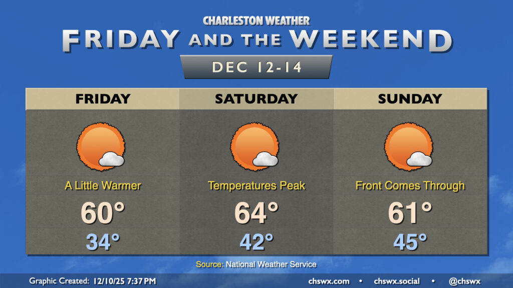
Overall, the weather pattern remains fairly progressive but largely quiet for the foreseeable future. High pressure will shift eastward and offshore on Friday, allowing temperatures to recover to the low 60s in the afternoon after a start in the mid-30s. Temperatures peak Saturday ahead of the next front, with lows in the low 40s and highs in the mid-60s. The aforementioned front comes through during the day Sunday. We start the day in the mid-40s and should reach the low 60s, but cooler and drier air blowing in behind the front will cap highs there and cool us off quite nicely heading into Monday, when we may start in the 20s with even lower wind chills.
Follow my Charleston Weather updates on Mastodon, Bluesky, Instagram, Facebook, or directly in a feed reader. Do you like what you see here? Please consider supporting my independent, hype-averse weather journalism and become a supporter on Patreon for a broader look at all things #chswx!