Friday & the weekend: Morning fog returns as temperatures peak ahead of a front
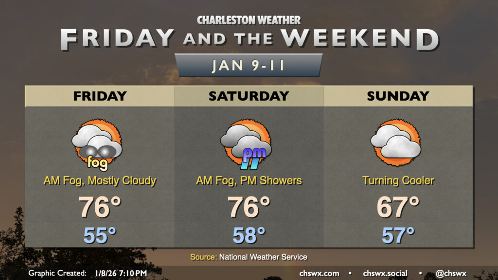
Another round of fog is expected overnight into Friday morning as abnormally warm temperatures continue across the Lowcountry. Lows will fall into the mid-50s, reaching the dewpoint with relatively calm winds. Once again, be prepared for low visibility and delays due to fog as you commute Friday morning. Like Thursday, the fog should mix out by mid-morning, and from there, temperatures will head to the mid-to-upper 70s. We’ll challenge the record high of 78° set in 2012 with a mix of sun and clouds in the afternoon.
The warmth will peak on Saturday ahead of a cold front that will knock temperatures down a good bit for Sunday. Temperatures Saturday may start in the upper 50s to near 60°, which will once again reach the dewpoint and allow for some fog formation. The record warm low temperature of 60° set in 1974 is under threat, as is the record high of 79° set in 2008. After sunset, we’ll see a risk of showers develop as the cold front approaches, but the risk is low as any prefrontal showers will be weakening as they approach — definitely not great for drought-busting purposes, for sure.
The front will be moving through Sunday morning. We’ll start in the mid-50s once more, but with the front moving by, temperatures will only peak in the upper 60s as cool air begins to move into the area. We’ll stay a bit on the cloudy side, with breaks in the clouds expected by afternoon. This will lead to a couple chilly days on Monday and Tuesday ahead of the next storm system arriving Wednesday.
Follow my Charleston Weather updates on Mastodon, Bluesky, Instagram, Facebook, or directly in a feed reader. Do you like what you see here? Please consider supporting my independent, hype-averse weather journalism and become a supporter on Patreon for a broader look at all things #chswx!