Weekend forecast: One more warm day before a front cools things off
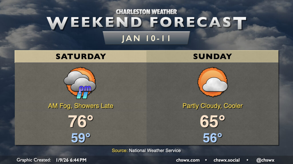
After a record high on Friday, we’ve got one more warm day ahead before a cold front begins to make things feel a little more like January for Sunday and especially the start of the new work week.
But first, we’ll likely get off to another foggy start across the area as lows fall to the upper 50s, once again butting right up against the dewpoint. (For contrast, the normal high for a mid-January day is 60°!) We’ll warm back into the mid-to-upper 70s once again, and the daily record high of 79° last set in 2008 may be threatened as a result. Much of the day will be rain-free, though we’ll be watching a line of weakening showers as it approaches the coast, which could bring some light rain to the area after sunset into early Sunday morning. However, any rain that falls won’t be remotely enough to dent the developing drought across the Lowcountry.
The front clears the area Sunday morning, and northwesterly winds will kick up in response as strong Canadian high pressure begins to build in from the west. We may see gusts 20-25 MPH during the day as a result as the cooler and drier airmass begins to build in. Some sunshine should peek out before the end of the day, but temperatures will struggle to the mid-60s before falling off quickly after sunset.
Looking ahead: Temperatures plummet below normal
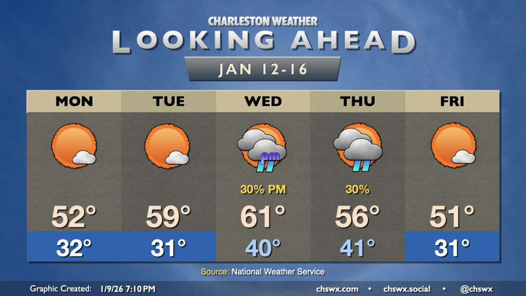
Next week will run much cooler than the previous week as the pattern flips to a much cooler setup especially as we get into late week. We’ll get below freezing for the first time in 2026 on Monday morning, warming to just the low 50s in the afternoon despite plenty of sunshine. After another subfreezing start on Tuesday, temperatures moderate closer to normal as a trough ushers another cold front our direction. Wednesday will be the warmest day of the week as we get right out ahead of the front, but this means that temperatures will run generally near normal. Showers are expected Thursday as the front gets through, and we’ll chill right back out for Friday with the front having passed by and high pressure building back in.
Follow my Charleston Weather updates on Mastodon, Bluesky, Instagram, Facebook, or directly in a feed reader. Do you like what you see here? Please consider supporting my independent, hype-averse weather journalism and become a supporter on Patreon for a broader look at all things #chswx!