Tuesday: Another chilly start, but a bit warmer in the afternoon
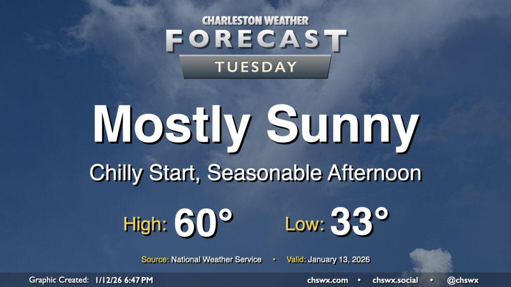
We’ll get off to another rather chilly start on Tuesday, with sheltered and rural locations headed below freezing and the metro getting awfully close (if not tipping below 32°F, too). At least the wind won’t be a factor — maybe a very light breeze, but that’s about it. Temperatures will then warm to around 60° in the afternoon, which if realized would be right on the nose for what climatology considers “normal” for January 13. Expect plenty of sunshine with just a few clouds.
Rest of the work week: Slight shower chance Wednesday as temperatures remain below normal, with increased fire danger Thursday
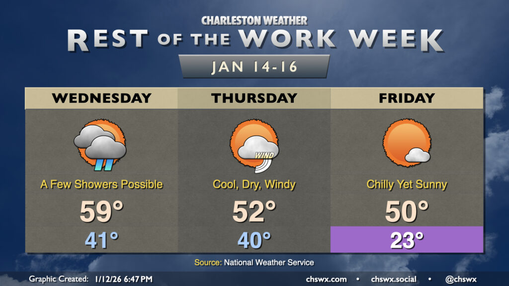
The rest of the work week could start with a few showers before temperatures take a plunge for Thursday and especially Friday. Low pressure moving north out of the Bahamas could help spread a few showers toward the area Wednesday morning through mid-afternoon, but whatever falls won’t have a material impact on the ongoing and worsening drought. Lows will run in the low 40s with highs peaking in the upper 50s to around 60° in the afternoon.
A front comes through on Thursday which will usher in a very cold and dry airmass. Strong winds behind the front with gusts potentially reaching or even exceeding 30 MPH will lead to elevated fire danger across the area given the dry air and drier fuels. Keep an ear out to local authorities for possible burning bans on Thursday. Temperatures Thursday afternoon start around 40°, but with the frontal passage, highs should only peak in the low 50s despite increasing sunshine.
High pressure settles in over the area overnight Thursday into Friday, allowing temperatures to crash into the low 20s and maybe even the upper teens in a few spots well inland. A pipe-busting freeze appears to be a possibility, so you’ll want to make sure cold weather precautions for people, plants, pets, and pipes are in place for Thursday night into Friday. Despite full sunshine, the cold airmass won’t really moderate a ton, and highs will struggle to 50° in the afternoon.
Temperatures will rebound slightly for Saturday, but another front knocks things right back down on Sunday with maybe a shower or two out ahead of it.
Follow my Charleston Weather updates on Mastodon, Bluesky, Instagram, Facebook, or directly in a feed reader. Do you like what you see here? Please consider supporting my independent, hype-averse weather journalism and become a supporter on Patreon for a broader look at all things #chswx!