Tuesday: Frigid start doesn’t get much warmer; below-normal temperatures to continue
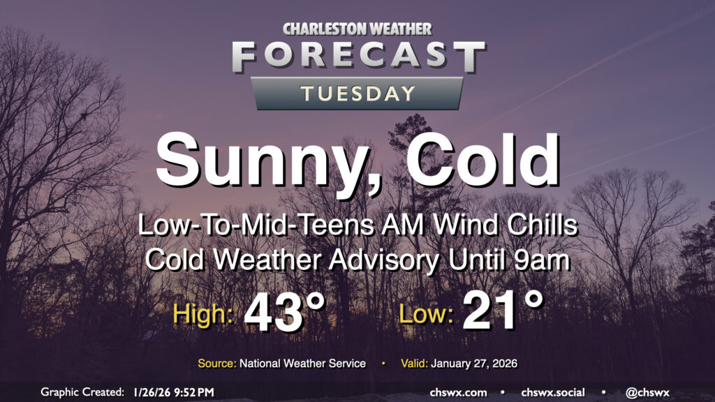
Tuesday will get off to a very cold start across the area as Arctic air continues to spill in, sending air temperatures to the low 20s and maybe even some upper teens further inland. Northerly winds around 5-10 MPH will make it feel closer to the low-to-mid-teens in the morning, prompting a Cold Weather Advisory that will run until 9am. Bundle up carefully and with plenty of layers for heading out to work or school as this is bitter cold for this part of the world. With cold air continuing to blow in, highs on Tuesday only peak in the low-to-mid-40s despite plenty of sunshine. This is well below normal for late January — climatological average high temperatures are around 61° at this point in the still-young year. Stay warm!
Rest of the work week: Temperatures moderate a little, but remain well below normal
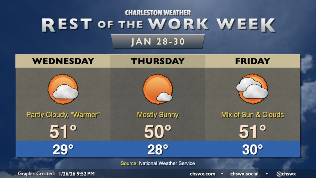
High pressure will remain the dominant weather feature for the rest of the work week. The cold air advection shuts off, and this allows the airmass to warm a little bit. And by a little bit, I mean highs around 50° and lows in the upper 20s to around 30°. It’s an improvement, but still running 10°+ below normal for this point in the year. The cool and dry airmass and persistent high pressure will keep things quiet in our neck of the woods through Friday, with an uptick in clouds on Friday as a front approaches with a reinforcing shot of cold air for the weekend.
Another shot at winter weather this weekend?
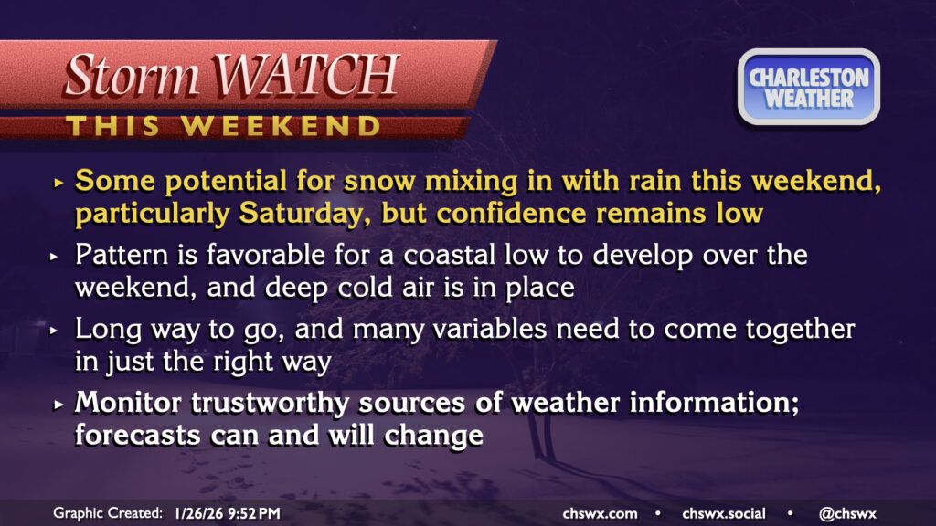
Another strong Arctic high pressure looks to build into the area in the wake of the front on Friday, sending temperatures plummeting back down into the low 20s for Saturday morning. As that’s happening, a piece of energy aloft looks to move out of the Great Lakes region and helps to spin up low pressure offshore. There’s pretty solid model consensus for the high level idea here, but the devil is, as always, in the details — where the surface low spins up is a big question mark, and right now there’s less agreement on this. There are also questions on how much moisture will be available, though a preponderance of the models suggests this may not be an issue (at least based on tonight’s data). If — and this is a load-bearing if — these ingredients come together in the right ways, that could drive the potential for at least some snow mixing in with rain on Saturday.
The usual caveats apply — it is very early still, and as we’ve seen the past couple weeks with possible winter weather, changes can and almost certainly will happen that will change the impacts. However, the favorable pattern and the locked-in cold air certainly helps the cause, and a coastal low is often the best way to wring out snow all the way to the ground as long as it is just far enough away, but not too far away.
It’s worth noting, too, that this pattern is very different from last weekend’s winter weather scare. Last weekend featured a warm conveyor belt of moisture a couple thousand feet up which overran a shallow layer of cold air at the surface, which is a classic freezing rain/sleet setup for this part of the world. The coastal low offshore draws more and deeper cold air in from the north, which keeps much more of the atmospheric column below freezing. This isn’t foolproof by any stretch; even when the surface low is positioned just right, we still often see some thin layers of warm air from the Atlantic cause some changeover to sleet or freezing rain as we saw in the 2018 snowstorm. That being said, this is the pattern you want if you want to see decent snow here. This is how we got the 1989 White Christmas, the 2018 snowfall, and the snowfall from just this past year.
Stay tuned…
Follow my Charleston Weather updates on Mastodon, Bluesky, Instagram, Facebook, or directly in a feed reader. Do you like what you see here? Please consider supporting my independent, hype-averse weather journalism and become a supporter on Patreon for a broader look at all things #chswx!