Rest of the work week: Below-normal temperatures continue ahead of a frigid weekend
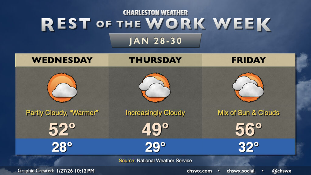
While it won’t be quite as chilly as Tuesday was, the rest of the week will continue to feature below-normal temperatures as Arctic air continues its residence across the area. Wednesday starts in the upper 20s, warming to the low 50s in the afternoon under a mix of sun and clouds. A dry front will sag south across the area Thursday, which will cool things off and cloud up the skies a little bit. Temperatures Thursday once again start in the upper 20s, warming to the upper 40s to about 50° in the afternoon. The cloud cover insulates us a bit overnight Thursday into Friday, with lows only dropping to the low 30s (and staying above freezing toward the coast). Highs Friday warm to the mid-50s as more onshore flow takes over.
Weekend preview: Bitter cold with a chance of snow
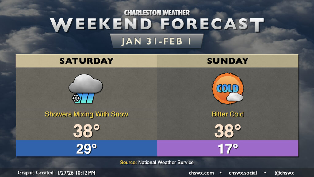
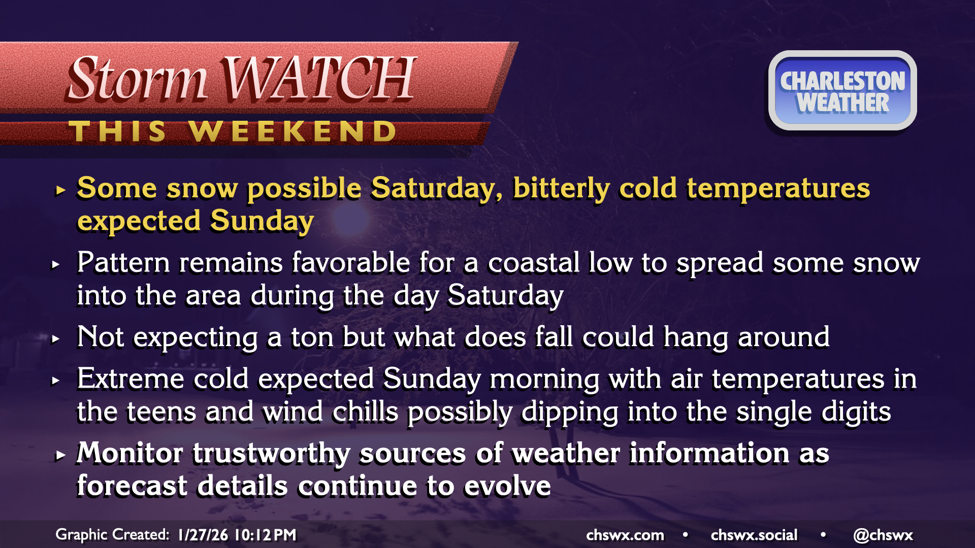
There are many details to be worked out, but things continue to trend toward a risk for winter weather here in the Lowcountry on Saturday as low pressure develops and skirts up the coast. It’s still a bit early to get into details on how much snow might fall (if any; this is not a done deal, either, especially if the low is further offshore). However, probabilities for some sort of minor winter weather impacts continue to increase as guidance has been pretty consistent with the positioning of the low pressure system and the presence of at least some moisture (though that is always a mitigating factor with these kinds of setups, too). This is certainly worth keeping an eye on, but continue to modulate your expectations accordingly and we’ll keep you posted as more data comes in.
What is almost certain, though, is that this is going to be a frigid weekend, especially if we do get some snowpack to stick around after Saturday’s precipitation. Sunday in particular could be particularly treacherous, with air temperatures falling into the mid-teens across the area. Wind around the departing low pressure system should be strong enough to send wind chills into the single digits, which is Extreme Cold Warning territory for this part of the world. This is the more certain hazard, so be ready to protect pipes, pets, plants, and people from the extreme cold.
Follow my Charleston Weather updates on Mastodon, Bluesky, Instagram, Facebook, or directly in a feed reader. Do you like what you see here? Please consider supporting my independent, hype-averse weather journalism and become a supporter on Patreon for a broader look at all things #chswx!