Thursday: Turning a little cooler before briefly warming on Friday; confidence improving in Saturday snow
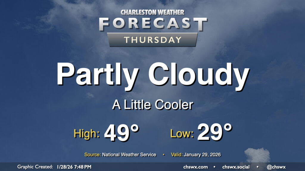
Another chilly day lies ahead for Thursday as a dry cold front slides southward across the area, reinforcing the cooler airmass that’s been in place for much of this past week so far. Temperatures will start in the upper 20s to around 30° for yet another subfreezing start this week. We’ll see some clouds at times, with greater cloud cover expected as we get into the evening, but otherwise there should be plenty of sunshine. Despite the sun, though, the reinforcing shot of cooler air keeps highs pinned to the upper 40s to around 50°.
Friday & the weekend: A brief warmup before what looks like a snowy Saturday
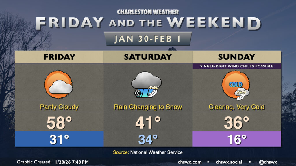
A warm front lifts across the area on Friday, allowing temperatures to approach something resembling normal (though still a few clicks below) for a brief spell before much colder air works its way in. Temperatures Friday start still just shy of freezing, but will warm to the mid-to-upper 50s in the afternoon with a mix of sun & clouds.
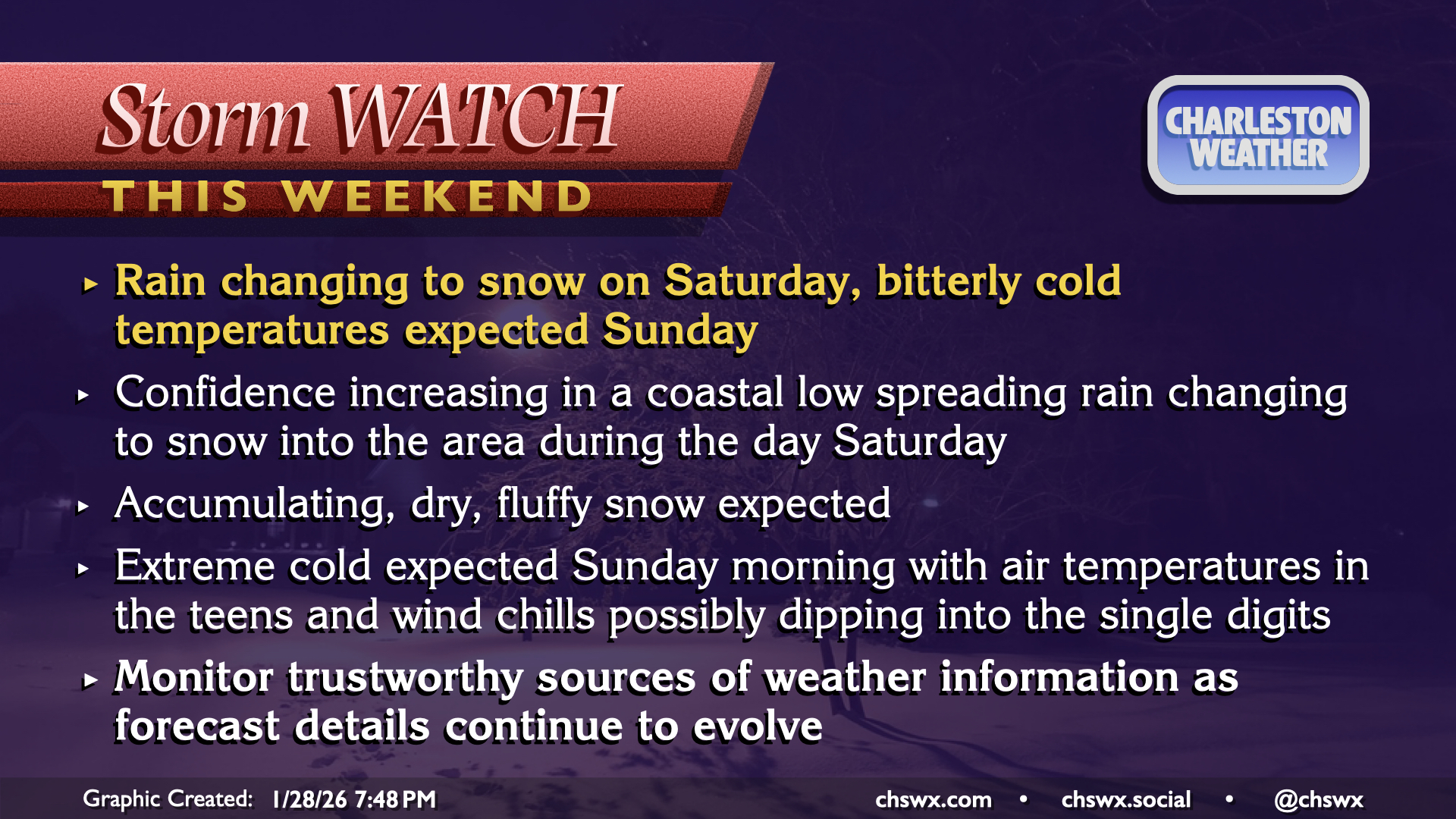
This changes rather quickly as the coastal low develops and begins moving northward, spreading moisture inland while drawing in much colder air behind it. We’ll start Saturday morning above freezing, with rain likely falling as we wake. As the deeper cold air works its way in, rain will begin to mix with snow before likely changing all the way over to snow by the evening. Snow should continue into early Sunday morning before the low pressure moves away. Don’t expect a lot of snow to accumulate, but 1-2″ may not be out of the question before it’s all said and done. It looks to be fairly fluffy, dry snow, too — rare for this part of the world, but there won’t be a ton of moisture available, either. Winds will be breezy, too, so you’ll want to make sure you’ve got a couple layers on if you’re going to be out and about having some fun with this.
From there, it will be quite, quite cold. The expectation of snow on the ground on Sunday morning in addition to the advecting Arctic airmass will get low temperatures off to a start in the mid-teens. It’s quite plausible that wind chills could dip into the single digits, too. This is considered extreme cold for this area, and an Extreme Cold Watch for Sunday is not out of the question in the next couple days or so. We will stay quite cold heading into the new work week, with another round of sub-20° air temperatures possible Monday morning before moderating a little bit for midweek.
Follow my Charleston Weather updates on Mastodon, Bluesky, Instagram, Facebook, or directly in a feed reader. Do you like what you see here? Please consider supporting my independent, hype-averse weather journalism and become a supporter on Patreon for a broader look at all things #chswx!