Thursday: Rain departs, and we chill back out
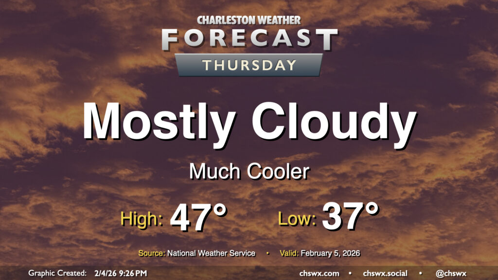
After some much-needed rain Wednesday, Thursday will be a much cooler day as a cold front moves by. Some showers may linger in the morning, but otherwise we can expect a mostly cloudy day with some peeks of sun from time to time. Expect temperatures to start in the mid-to-upper 30s, warming to just the mid-40s in the afternoon given the cloud cover and cooler air blowing in from the north.
Friday & the weekend: Cooler-than-normal temperatures continue despite lots of sun
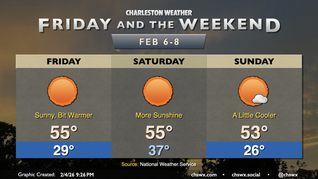
A quiet weekend of weather awaits (finally!) as high pressure remains the main weather feature, though a dry front will swing through Saturday and knock temperatures down for Sunday. Friday will start in the upper 20s, warming to the mid-50s with virtually unfettered sunshine. The aforementioned front comes through early in the day Saturday, so while we start the day 5-8° warmer (mid-to-upper 30s), highs will peak about where they did Friday with cooler air moving back into the area. Sunday starts off on a fairly cold note as lows fall back to the mid-20s, and despite mostly sunny skies, highs will struggle into the low-to-mid-50s.
Changes are coming for next week, though, as high pressure becomes situated over Florida. The resulting west and southwesterly winds should warm things up quite nicely, and we’re looking for highs in the 60s for much of the week, perhaps even approaching 70° by mid-week. This should be a nice respite from what’s been a pretty chilly few weeks, so hang in there!
Follow my Charleston Weather updates on Mastodon, Bluesky, Instagram, Facebook, or directly in a feed reader. Do you like what you see here? Please consider supporting my independent, hype-averse weather journalism and become a supporter on Patreon for a broader look at all things #chswx!