Tuesday: The 70s return
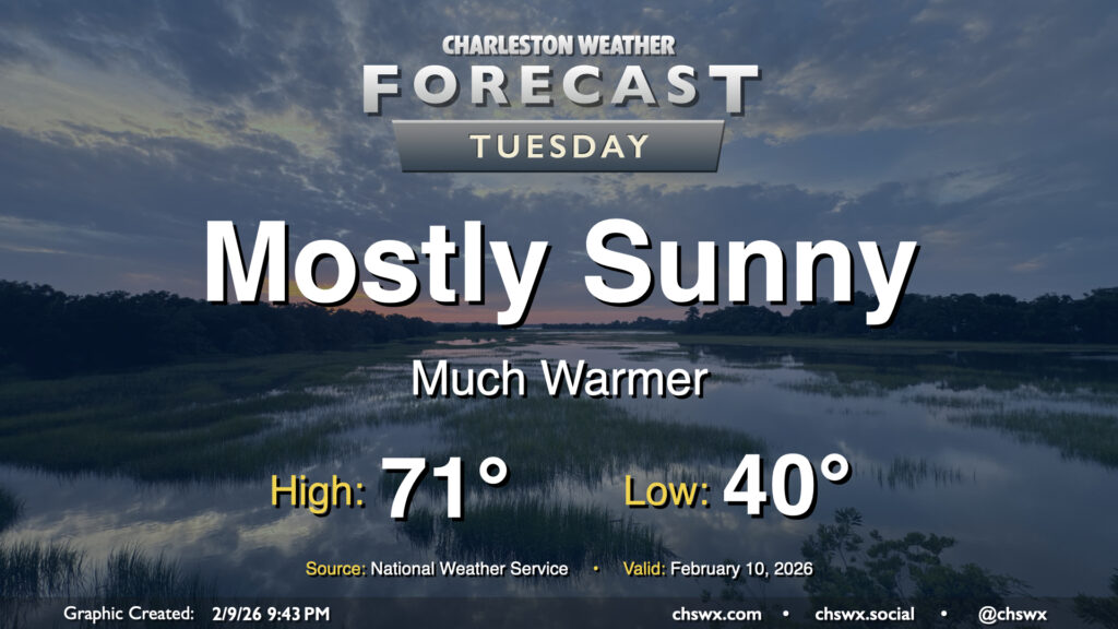
One could make the argument that Tuesday’s forecast might be the most pleasant in a few weeks as temperatures head well above normal as we end up on the north side of high pressure centered roughly around Tampa, FL. We’ll start the day around 40°, but west and southwest winds along with mostly sunny skies will help drive temperatures some 30° warmer during the day, with highs reaching the low 70s across much of the area (save for the immediate coast, where marine influences will keep temperatures capped to the upper 50s to around 60°). This should be our first 70° day since January 22, when the high reached 72°.
Rest of the work week: Shower chances return with a slight cooldown
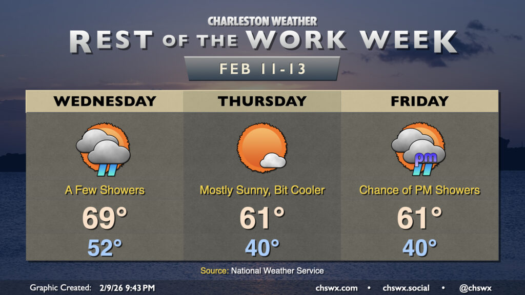
We’ll stay on the warm side of normal on Wednesday as a cold front approaches from the northwest, though we should see some showers develop out ahead of it. It’ll be another warmer-than-normal day, with lows in the low 50s to start the day before warming to the upper 60s to around 70° in the afternoon. The aforementioned showers (along with increased cloud cover in general) will keep highs from reaching Tuesday’s peaks, but it’ll still be several degrees above normal for this point in the year. As far as rainfall goes, it’ll be feast or famine; some folks may only get a trace (if any at all), while others could see about a quarter-inch. Certainly not a drought buster any way you slice it, though.
The cold front gets south of the area early Thursday, clearing our skies and cooling us off a bit. It’s not a terribly sharp cooldown (certainly not by recent standards), but highs will peak closer to if not ever-so-slightly below normal — think low 60s. It’ll still be a nice day, though. Cloud cover will start to tick back up on Friday as the front to the south stalls out and moisture begins to overrun it a bit more. Temperatures will still get to the low 60s despite the cloud cover. There’s an outside shot of a few showers Friday evening, but the better rain chances arrive over the weekend, particularly on Sunday as a cold front moves through in a setup that could potentially yield some thunderstorms.
Follow my Charleston Weather updates on Mastodon, Bluesky, Instagram, Facebook, or directly in a feed reader. Do you like what you see here? Please consider supporting my independent, hype-averse weather journalism and become a supporter on Patreon for a broader look at all things #chswx!