Tuesday: Warming trend begins with plenty of sunshine
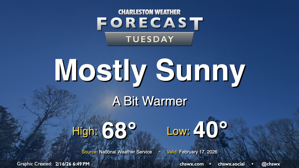
A warming trend kicks off Tuesday as high pressure moves overhead and eventually offshore. It’ll be quite a nice day after we start around 40° in the morning; temperatures will head well into the 60s by afternoon with plenty of sunshine to be had and comfortable relative humidity values. Winds won’t be quite as strong as they were on Monday, either, with speeds generally around 5 MPH. Winds will shift around to the southeast as high pressure slips into the Atlantic, a harbinger of warmer air to come.
Rest of the work week: Well-above-normal temperatures expected — and some showers, too
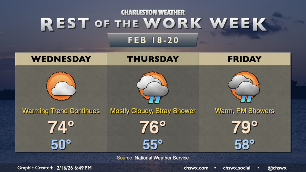
Temperatures take quite a leap for a few days starting Wednesday. Expect lows around 50° to give way to highs in the mid-70s under partly to mostly cloudy skies. We’ll turn even warmer as we get beyond Hump Day, with lows in the mid-to-upper 50s and highs in the mid-to-upper 70s to close out the work week. A stray shower or two could pop up on Thursday, while Friday seems to offer better shower chances on the nose of even warmer air pushing into the area. Shower chances will persist into the weekend before a cold front clears the area for Monday.
Follow my Charleston Weather updates on Mastodon, Bluesky, Instagram, Facebook, or directly in a feed reader. Do you like what you see here? Please consider supporting my independent, hype-averse weather journalism and become a supporter on Patreon for a broader look at all things #chswx!