Thursday: Warmth continues; stray shower possible
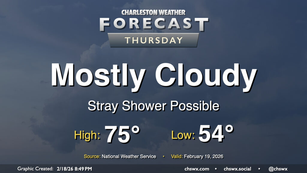
We’ll see more in the way of cloud cover and maybe even a few showers on Thursday, but that won’t stop temperatures from getting back to the mid-70s after a warm-for-February start in the mid-50s. Deep southwesterly flow will continue to pump warm and moist air into the area, and as temperatures warm into the 70s, this could spawn a few popup showers (not something we often say in February!) along with gusts around 20-25 MPH.
Friday & the weekend: Cold front instigates more unsettled — and eventually cooler — weather
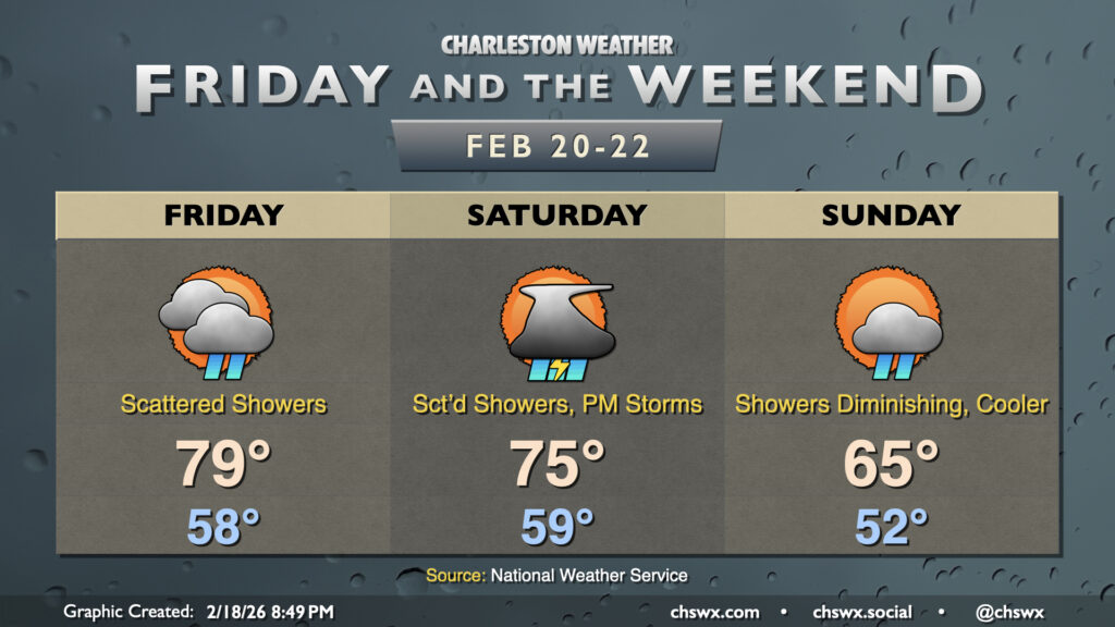
We’ll see more in the way of unsettled weather as we head into Friday and the weekend courtesy of a cold front. Our recent warm spell looks to peak on Friday before more widespread rain looks to move in for Saturday. Highs on Friday could top out in the upper 70s and may even touch 80° in a few spots depending on cloud cover and shower coverage. It won’t rain all day, but some brief downpours may be possible as the atmosphere continues to moisten.
The best chance for showers and maybe a few thunderstorms will arrive Saturday with the cold front. Scattered showers and storms will be possible for much of the day, with the greatest chance for showers and thunderstorms generally in the afternoon through the evening as the front moves by. Some heavy downpours are possible, but severe weather doesn’t look to be a major concern in the Charleston metro. (Locations to the south and west could see a sporadic damaging wind report or two, though.) Temperatures Saturday will start near 60°, but the cloud cover and showers should keep highs capped in the mid-70s.
We’ll turn cooler on Sunday in the wake of the front. Some showers may linger as low pressure deepens off the North Carolina coast, flinging some wraparound moisture our direction. However, shower chances diminish throughout the day along with the cloud cover. Temperatures start in the low 50s, but will warm just to the mid-60s — some ten degrees cooler than Saturday. Even cooler weather is expected for at least the first half of next week, with temperatures perhaps even dipping below freezing Tuesday morning. (It is, after all, still winter.)
Follow my Charleston Weather updates on Mastodon, Bluesky, Instagram, Facebook, or directly in a feed reader. Do you like what you see here? Please consider supporting my independent, hype-averse weather journalism and become a supporter on Patreon for a broader look at all things #chswx!