Thursday: Cold front arrives with showers, a few thunderstorms
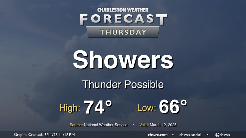
After a new daily record high of 89° was set at the airport on Wednesday, changes are forthcoming as we head into Thursday as a cold front approaches the area. We will start the day quite warm — record warm low temperatures are not out of the question — with lows in the mid-60s at coolest. Temperatures will then head into the mid-70s before a band of showers and thunderstorms approaches the area by mid-morning. Brief periods of heavy rain are possible, but storms will be moving quickly, so no concerns about too much rain in one location. Any rain we can get remains helpful as severe drought continues across the Lowcountry. There could be some thunder, too, and a few strong thunderstorm wind gusts can’t be totally ruled out as the line gets through.
The front will sweep the moisture and warm airmass offshore by evening, and temperatures will drop quickly into the 50s in its wake. If you are out and about Thursday evening, keeping a light jacket close by may not be the worst idea!
Friday & the weekend: Brief shot of cooler air before a bigger shot arrives next week
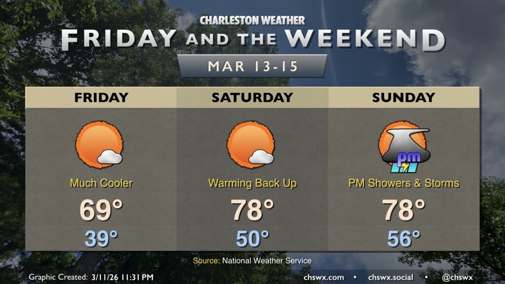
Wednesday’s heat will feel like a distant memory Friday morning as lows bottom out in the upper 30s across the metro. High temperatures will be closer to mid-March norms, topping out in the upper 60s to around 70° with plenty of sunshine to be had.
The cooldown doesn’t last terribly long, though, as winds go back southerly ahead of the next (and more potent) cold front that will affect the area late weekend into the start of the new work week. Temperatures on Saturday begin around 50°, warming to the upper 70s in the afternoon with ample sunshine once again. Suffice it to say, there are no concerns for outdoor St. Patrick’s festivities around town.
The next front begins to affect the area on Sunday. We’ll start the day rain-free, but shower and thunderstorm chances increase as we head into the afternoon and evening as the front draws closer. Lows will run a bit warmer than they did Saturday, with mid-50s generally expected. Highs in the upper 70s are once again forecast ahead of things turning more unsettled. This unsettled weather lasts into Monday before the front clears the area, bringing about a much cooler St. Patrick’s Day proper on Tuesday.