Tuesday: Much cooler in the wake of the front
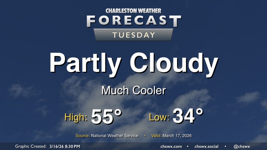
Thankfully, the atmosphere did not live up to its potential on Monday, leaving us to get some much-needed rain without any of the shenanigans that we thought might come with. The cold front is through now, and temperatures will be falling into the mid-30s overnight in the metro, with subfreezing temperatures expected further inland, perhaps in parts of Berkeley and Dorchester counties. Elsewhere, frost shouldn’t be much of a factor given elevated winds continuing overnight.
Temperatures will only peak in the mid-50s on Tuesday despite plenty of sunshine, owing to the potency of the cold airmass.
Rest of the work week: Frost and freeze concerns for Tuesday night, then warming as we head to the weekend
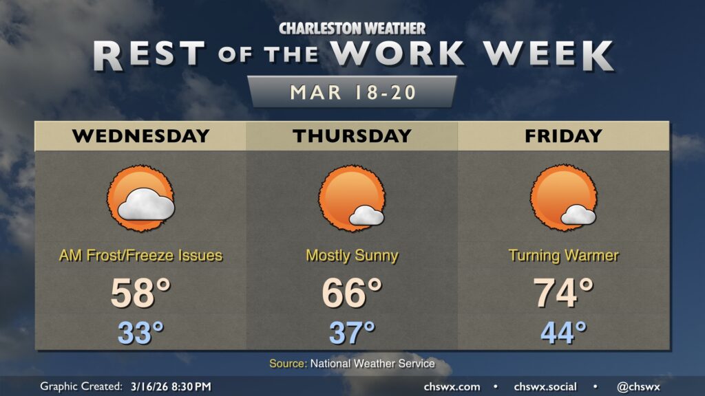
The only weather concern for the rest of the work week will be the risk for frost and freeze issues Tuesday night into Wednesday morning. Lows will fall below freezing away from the coast, and with calmer winds compared to Monday night, frost should develop pretty much everywhere else. You’ll want to protect sensitive vegetation for sure Tuesday night through Wednesday morning as a result.
Temperatures will warm to the upper 50s on Wednesday, but a warming trend will take hold from there. Aside from some frost concerns inland Thursday morning, we’ll be getting back to more springlike conditions just in time for the vernal equinox on Friday. Highs Thursday peak in the mid-60s, and then we’re back to the mid-70s on Friday, with temperatures perhaps touching 80° again over the weekend.