Thursday: Frosty start, but a little warmer
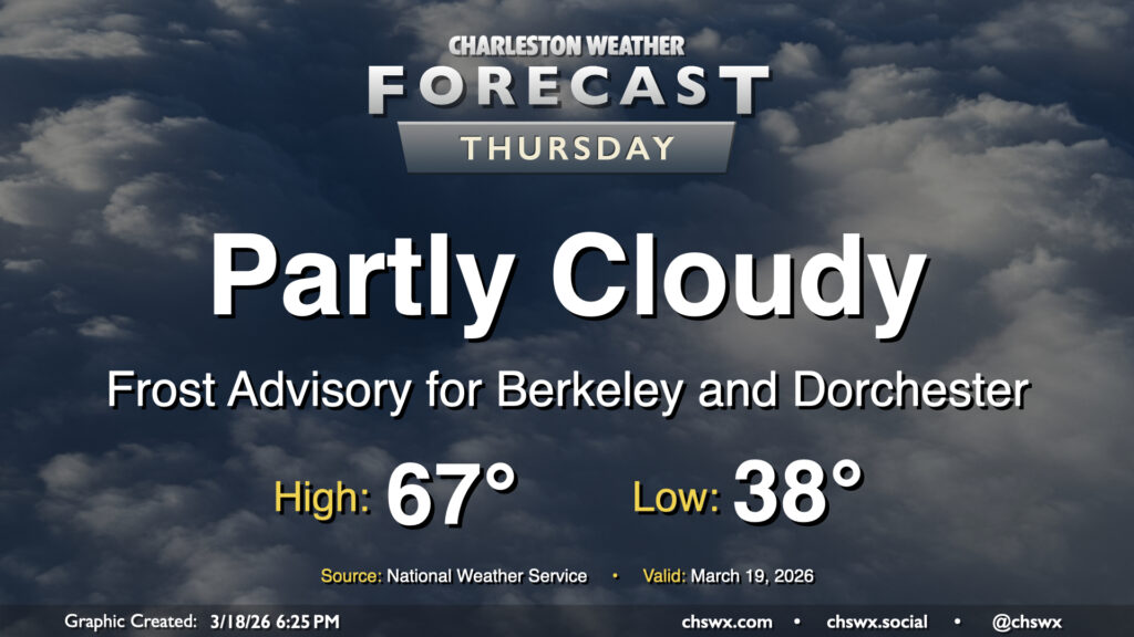
Another frosty start awaits for Thursday as temperatures fall to the upper 30s in the metro and a little lower across inland locations. Calmer winds and higher dewpoints will allow for frost formation overnight, particularly in Berkeley and Dorchester counties where a Frost Advisory is in effect through 9am. From there, it’ll feel much warmer than it did on Wednesday, with highs expected to peak some 10° warmer Thursday afternoon, generally in the mid-to-upper 60s. Cloud cover will be a bit variable, but generally expect a fair bit of sunshine throughout the day with no concerns for precipitation.
Friday & the weekend: Spring-like temperatures return just in time for the start of astronomical spring
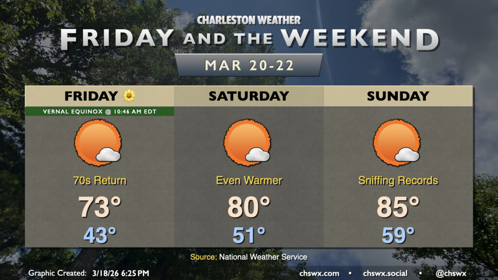
The warming trend continues as we head into the weekend. We’ll be clear of any residual frost and freeze threat Friday as lows moderate to the low-to-mid-40s, followed by highs peaking in the low-to-mid-70s in the afternoon with plenty of sunshine. Friday will mark the first day of astronomical spring as well, with the vernal equinox taking place at 10:46am.
More sunshine and even warmer temperatures are expected for the weekend with high pressure remaining in control. Highs Saturday peak around 80°, while Sunday heads into the mid-80s, potentially encroaching on the record of 88° set in 2011.
The next rain chance arrives late Monday into Tuesday as a front drops in from the north, which will cool us back off for a few days in the middle of next week. We will get a new Drought Monitor on Thursday, but I’m not expecting much change from the ongoing severe drought despite some recent rainfall.
Follow my Charleston Weather updates on Mastodon, Bluesky, Instagram, Facebook, or directly in a feed reader. Do you like what you see here? Please consider supporting my independent, hype-averse weather journalism and become a supporter on Patreon for a broader look at all things #chswx!