Tuesday: Turning much, much cooler
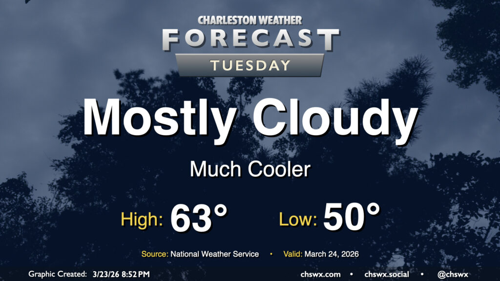
Tuesday could be quite a shock to the system after Monday’s record warmth. We’ll go from a high of 90° on Monday, which was not only a daily record high but the fourth earliest 90° day on record, to a high in the low 60s on Tuesday with mostly cloudy skies in the wake of a cold front that is entering the Tri-County area as of this writing. No rain is expected, but we can expect breezy northeasterly winds as a cold air damming regime takes hold, at least briefly.
Rest of the work week: Temperatures climb again
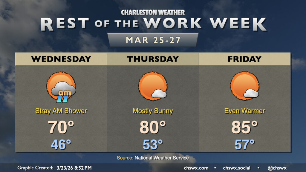
After Tuesday’s significant cooldown, we’ll begin to warm back up on Wednesday as the wedge of high pressure slowly breaks down. A stray shower or two will be possible Wednesday morning; otherwise, expect lows in the mid-40s to warm to around 70° in the afternoon with a bit more sunshine than we expect to see Tuesday. The warming trend ramps up on Thursday, with highs around 80° expected under mostly sunny skies, while Friday will run even warmer with highs peaking in the mid-80s.
Bridge Run forecast: Turning cooler again
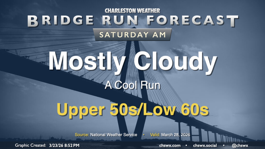
Another front will swing through early Saturday, which will keep temperatures in check for the Bridge Run. Expect a generally cool run this go-around, with temperatures in the mid-to-upper 50s expected at start time, warming to the low-to-mid-60s by noon or so with plenty of cloud cover. There’s an outside shot that precipitation could be a factor with the nearby front, but so far probabilities appear quite low. Stay tuned for updates this week!
Follow my Charleston Weather updates on Mastodon, Bluesky, Instagram, Facebook, or directly in a feed reader. Do you like what you see here? Please consider supporting my independent, hype-averse weather journalism and become a supporter on Patreon for a broader look at all things #chswx!