Tuesday: 80s return
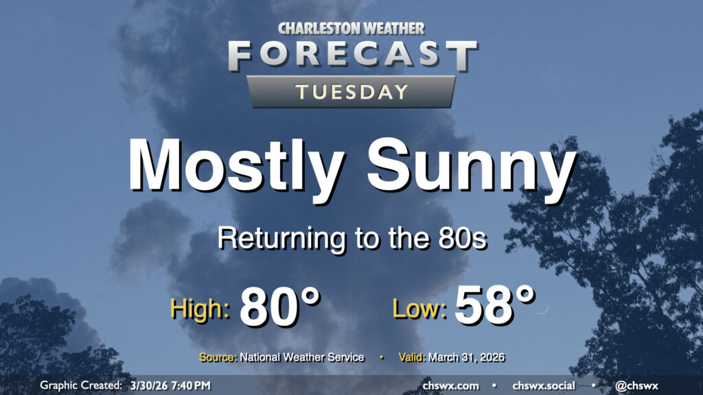
After a couple cooler days, the 80s return to the Lowcountry starting Tuesday and lasting well into the beginning of April. High pressure remains the main weather feature, keeping us generally on the quiet side. A southerly breeze around 5-10 MPH will be common, especially as we get into the afternoon. Thankfully, some higher dewpoints will also continue to put a dent in the fire danger.
Rest of the work week: 80s continue, a few showers possible in the afternoons
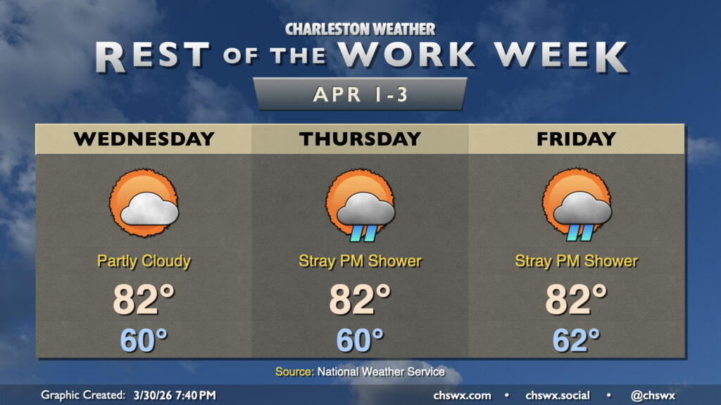
Temperatures will remain well above normal to start April as high pressure in the Atlantic remains the primary weather feature for the rest of the work week. Generally speaking, we can expect low 60s in the morning, with low 80s each afternoon. There’s an outside shot at a stray afternoon shower within the southerly flow, but otherwise, dry weather will continue (and those showers don’t look to amount to much rainfall-wise, either — not great for the ongoing and worsening drought). Thankfully, the onshore component to the wind will keep temperatures from getting too out of hand like they have done a few times so far in March.
Slightly better rain chances enter the forecast as we get into the weekend with a front approaching the area, but early indications are that we still won’t see much in the way of total rainfall (though any rain is helpful). Temperatures will remain above normal through the weekend.
Follow my Charleston Weather updates on Mastodon, Bluesky, Instagram, Facebook, or directly in a feed reader. Do you like what you see here? Please consider supporting my independent, hype-averse weather journalism and become a supporter on Patreon for a broader look at all things #chswx!